Ottoman-Habsburg Wars (1521-1791)
Images from eight wars fought between 1570 and 1718
View of the siege of Malta, 1565 (Malta, independent political entity) 35°55ʹ00ʺN 14°26ʹ00ʺE
published 1565Etching with engraving; printed on paper; mounted on paper (Mount Type A); gilt edges left, bottom and right | 35.5 x 50.9 cm (image and sheet) | RCIN 721038
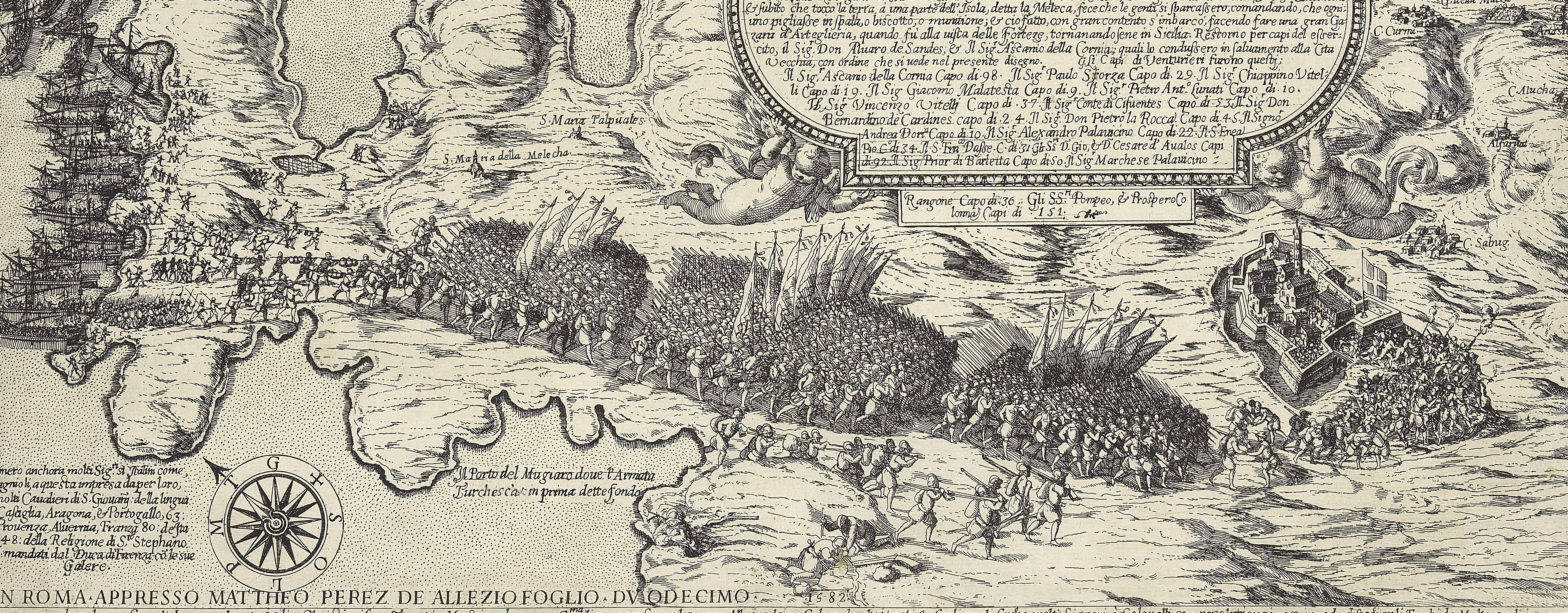
A high oblique view/map of the Great Siege of Malta between 18 May and 11 September 1565 carried on by the Turks, commanded by Kara Mustafa Pasha (c.1500-7 August 1580), and defended by the Knights of the Order of St John under Grand Master Jean Parisot de Valette (4 February 1495-21 August 1568), resulting in the abandonment of the siege by the Turks on the arrival of a Spanish fleet and army commanded by García Álvarez de Toledo, 4th Marquis of Villafranca (29 August 1514-31 May 1577). The Ottoman Empire (1500-1606): Conflicts in the Mediterranean (1532-1565). Oriented with south-west to top.
First issue of the second state (Mason, 1989, no.3, does not distinguish between the states); a second issue of the second state was published by Orlandi in 1602 (LDOSJ 1317). Examples of this map occur in Lafreri atlases.
This print shows the peninsula of St Elmo and the opposite fortifications.
Antoine Lafréry (1512-77) (publisher) [bottom of title panel:] Ant. Lafrerj Romæ formis 1565 de mese Augusti :
Subject(s)
Army-TurkeyNavy-TurkeyWatermark: Three-runged ladder in shield, six-pointed star above [Woodward nos 243-54]
Condition: one fold line. Verso: central longitudinal brown stain, perhaps from the removal of the adhesive fixed to an old, now removed, guard
35.5 x 50.9 cm (image and sheet)
cropped (platemark)
41.7 x 54.9 cm (mount)
Printed title:
Vltimo disegno delli forti di Malta uenuto nuouamente : / Doue si vede la batteria che fanno le Turchi per li arte = / gliaria posta In diuersi luoghi. Appresso si mostra il / luogo de doue li Turchi hanno transportato li schifi è / Barche per Terra in Mare, per dare l' assalto d' Improuiso / à San Michele et come sono state Affondate dalli ss.ri / Caualieri et soldati et si Vedo il porto di Marze musetto / doue hoggi sta l’Armata del Turco segnato per lettera A / et se il tutto non è cosi limato, come si douria Imputase / alli torbolenti tempi, che non lassano fare à quelli che / sonno in malta (quali hanno mandato il disegno) le cose con / quella Comodità che se recerca, et quello che si fà, tutto / è, accio li gentili spiritj habbino Continuo Cose nuoue: [top right, in a panel]
Annotations:
George III heading: Malta 1565.
Other annotations: (Recto) none. (Verso) [top left, across mount and map, red pencil:] 1/34; [top left, black pencil, erased and very faint:] I/[?]e.
George III catalogue entry:
Malta A Plan of the Forts of the Island of Malta, with the attacks of the Turks: by Antonio Lafreri, 1565.
Subject(s)
Malta, independent political entity (35°55ʹ00ʺN 14°26ʹ00ʺE)
Bibliographic reference(s)
M. McDonald, The Print Collection of Cassiano dal Pozzo. Part II, Architecture, Topography and Military Maps, 3 vols, London 2019, cat. no. 2685
R.V. Tooley, ‘Maps in Italian atlases of the sixteenth century, being a comparative list of the Italian maps issued by Lafreri, Forlani, Duchetti, Bertelli and others, found in atlases’, Imago Mundi III, 1939, pp. 12-47, no. 384
Page revisions
25 May 2024
Current version


