Contemporary maps and prints of the major battles and sieges from 1635 to 1658
Map of the siege of Cremona, 1648 (Cremona, Lombardy, Italy) 45°07ʹ59ʺN 10°01ʹ16ʺE
1648Etching; printed on paper; mounted on paper (Mount Type B); gilt edges top and right | 41.4 x 28.0 cm (image) | RCIN 723086
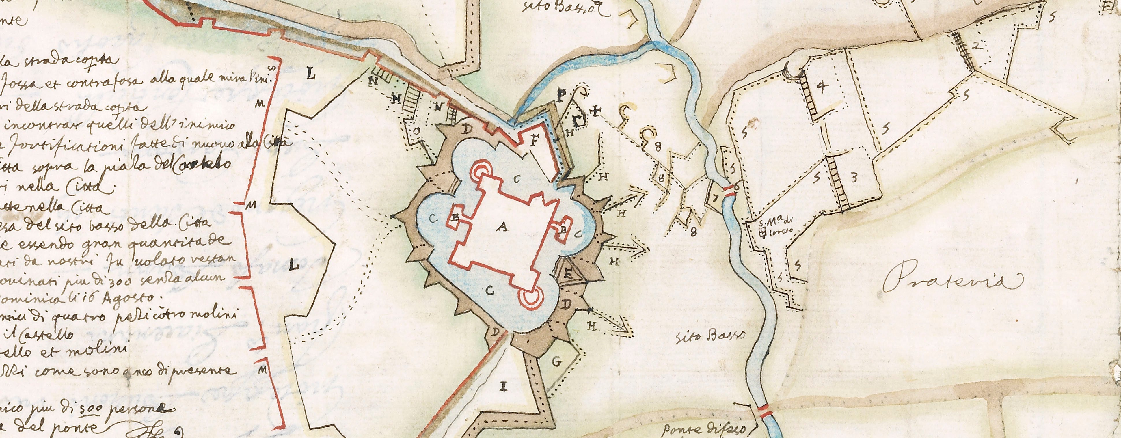
A map of Cremona, besieged from 21 July to 15 October 1648 by the French, allied with Italy and commanded by Francesco I d'Este, Duke of Modena (6 September 1610-14 October 1658) and Don Luigi de Benavides, Marchese di Caracena, Governor of the State of Milan and General of the Italian army. They abandoned the siege on 15 October. Franco-Spanish War (1635-1659). Oriented with north-west to top (cardinal points).
See RCIN 723084.
This map shows the state of the siege in August 1648 and the position of the defences around the castle of Cremona, which was situated at the north-western end of the town, together with a small section of the town itself and the fortifications and encampment of the besieging army at that location.
The wording of the statement of date in the title, referring to 'this year' of 1648 (q.to Anno 1648) tends to suggest that the print may have been published in 1648.
François Collignon (c.1610-87) (etcher and publisher) [along bottom of map, below the border:] Francesco Collignon Sculpsit Romæ con licentia de Superiori et si Vendono nella sua Botega nel Imperione alla Cantonata / del Vicolo della posta Vechia del Papa incontro al Toson d’oro.
Subject(s)
Army-FranceWatermark: Map: fleur-de-lys in circle, crown above. Mount: none.
Condition: some foxing
41.4 x 28.0 cm (image)
cropped (platemark)
29.7 x 28.0 cm (neatline)
41.7 x 28.1 cm (sheet) (whole object)
51.4 x 39.5 cm (mount)
Printed title
LA PIANTA ET DISEGNO DEL CASTELLO DELLA CITTA DI CREMONA / con anco le sue fortificat.ni esteriori et parte della Citta a quetto cōfinante con la di essa fortificatio.e in caso di ritirata da esso, Et / insieme le fortificationi fatte dal Inimico per auanzarsi c.a detto Castello et Assedio di esso et essa q.to Anno 1648. dal Meze d’Agosto. [top, in banderole]
Additional text:
[bottom, below map, in three columns, a key, 1-34, to military features and installations, roads, wells, and the gates of the town.
Annotations:
George III heading: Cremona August 1648.
Other annotations: (Recto) [top right, black pencil:] 1648. (Verso) none.
George III catalogue entry:
Cremona La Pianta et Disegno del Castello della Citta di Cremona con le Fortificationi nel mese d’Agosto 1648: da F. Collignon.
Subject(s)
Cremona, Lombardy, Italy (45°07ʹ59ʺN 10°01ʹ16ʺE)
Bibliographic reference(s)
M. McDonald, The Print Collection of Cassiano dal Pozzo. Part II, Architecture, Topography and Military Maps, 3 vols, London 2019, cat. no. 3207
Page revisions
25 May 2024
Current version


