Contemporary maps and prints of the major battles and sieges from 1635 to 1658
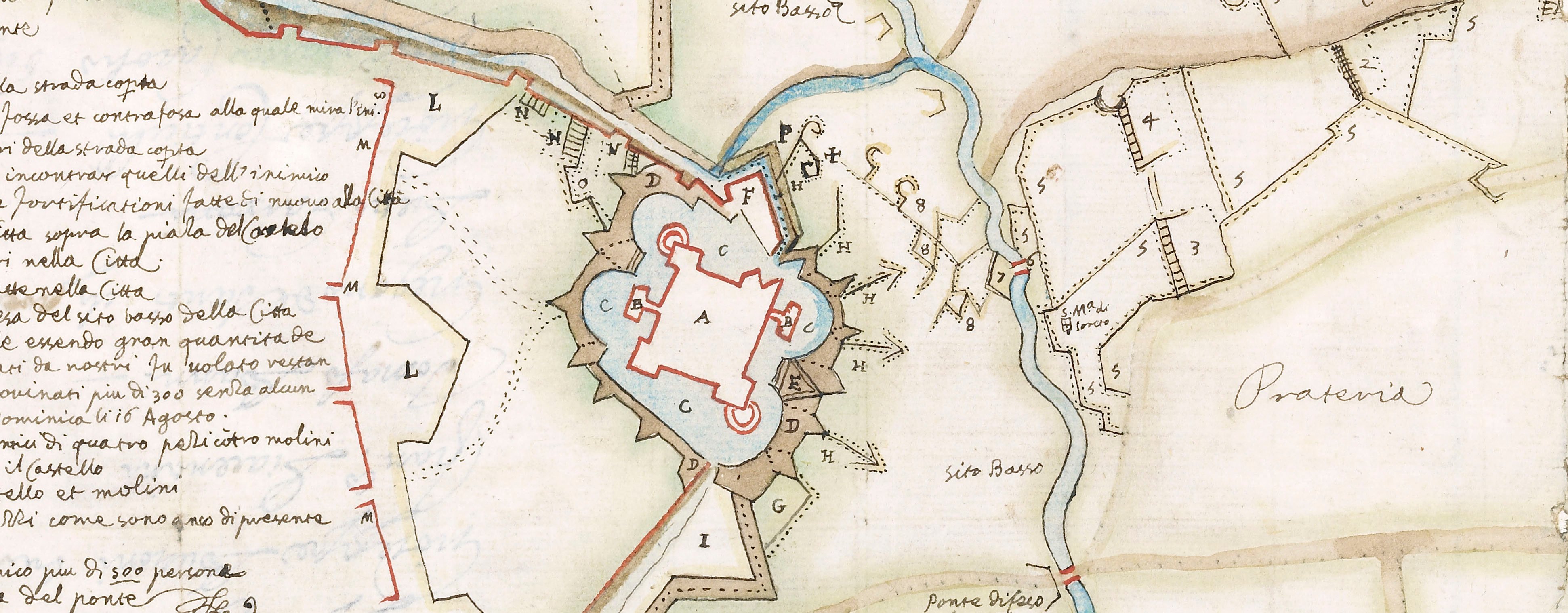
Map of Tortona, 1643 (Tortona, Piedmont, Italy) 44°53ʹ52ʺN 08°51ʹ49ʺE
published 1643Engraving; printed from two copperplates on two sheets of paper, joined; mounted on paper (mount is cropped) | Scale not stated | RCIN 723024.a
A high oblique view/map of Tortona, showing the circumvallation of the town, ordered by Don Giovanni de Velasco e della Cueva, conte de Sirvela, Governor of Milan (February 1641-August 1643) and constructed by the Spanish army after they had recovered the fortress from the French on 7 February 1643. Franco-Spanish War (1635-1659). Oriented with east to top.
The print shows the state of the fortifications between their construction after 7 February and the marches and camps of the French relief army between 17 and 27 May 1643 as they advanced to try to raise the siege. The outlying villages of Vigazzolo (Viguzzolo 44°54ʹ20ʺN 08°55ʹ11ʺE) and Sarazana (Sarezzano 44°52ʹ05ʺN 08°54ʹ48ʺE) are shown. Many of the commanders of both sides are named.
Francesco Prestino, who was probably the surveyor and draughtsman of this map, as well as designing the defence works it portrays, was a Milanese military engineer (hence the scale is given in Milanese units of measure) who was succeeded as a Captain of engineers by Gaspare Beretta in 1649. Prestino was the author of several surveys of fortifications (see also RCINs 722098 and 722150).
The accompanying letterpress text (RCIN 723024.b) gives details of which part of the circumvallation was constructed by whom – naming several Spanish personnel – and of the marches and positions of the enemy. The print is dedicated by Prestino to the Governor of Milan at that time, the conte de Sirvela.
Cesare Bassano (1583-1648) (etcher) [bottom right of view/map:] Cesare Bassani F.
Francesco Prestino (fl. c.1635-43) (dedicator, surveyor, draughtsman and publisher)
Subject(s)
Army-FranceWatermark: Cropped: a crown
Condition: five fold lines. Verso: remains of [Mount Type B?]
Scale not stated
58.7 x 54.3 cm (image and sheet)
cropped (platemark)
Printed title:
DESCRITTIONE / DELLA CIRCONVALLATIONE FATTA PER ORDINE / DELL’ ILLVSTRISSIMO, ET ECCELLENTISSIMO SIG.R CONTE DI SIRVELA, / Per la ricuperatione del Castello di Tortona, dal Capitan Sargente Maggiore Francesco Prestino Ingegnero Maggiore dell’ Essercito, doppo presa la Città li 7. Febraro 1643. [no title; accompanying letterpress title (RCIN 723024.b)]
Annotations:
George III heading: Tortona 7 Feb.y 1643.
Other annotations: (Recto) none. (Verso) [top left, black pencil:] 1643.
George III catalogue entry:
Tortona Descrittione della Circonvallatione fatta per ordine del Conte di Sirvela per la ricuperatione del Castello di Tortona; dal Cap. Francesco Prestino Ing.ro li 17 Febraro 1643: intagliata da Cesare Bassani. [with a Description]
Subject(s)
Tortona, Piedmont, Italy (44°53ʹ52ʺN 08°51ʹ49ʺE)
Bibliographic reference(s)
For Prestino, see A. Dameri and R. Livraghi, ‘Allessandria disegnata: Città e cartografia tra XV e XVIII secolo’, I Quaderni del Collegio Costruttori ance Alessandria, 2009, pp. 24-25
M. McDonald, The Print Collection of Cassiano dal Pozzo. Part II, Architecture, Topography and Military Maps, 3 vols, London 2019, cat. no. 3110
Page revisions
25 May 2024
Current version


