Contemporary maps and prints of the major battles and sieges from 1635 to 1658
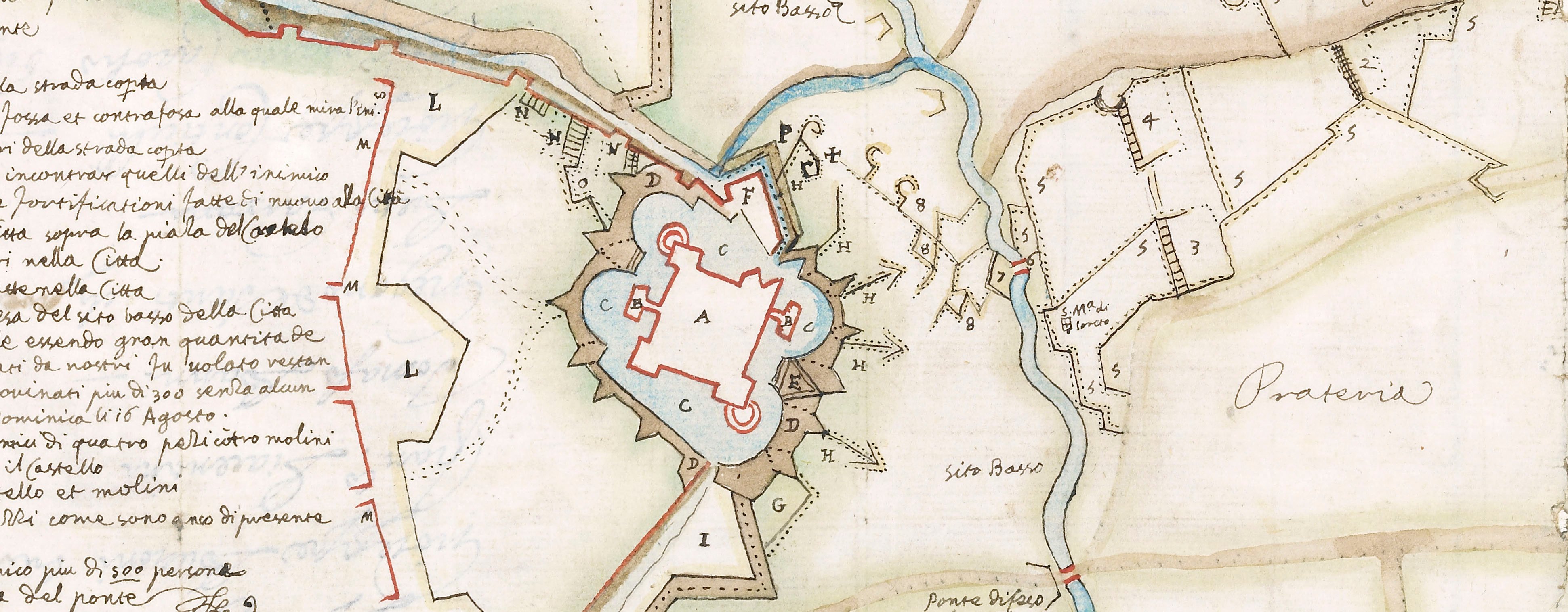
Map of the siege of Cremona, 1648 (Cremona, Lombardy, Italy) 45°07ʹ59ʺN 10°01ʹ16ʺE
1648 or laterEtching and engraving; printed on paper; mounted on paper (Mount Type B); gilt edges right and bottom | Scale: scale of main map not stated. 1:3,000 approx. | RCIN 723084
A map of Cremona, besieged from 21 July to 15 October 1648 by the French, allied with Italy and commanded by Francesco I d'Este, Duke of Modena (6 September 1610-14 October 1658) and Don Luigi de Benavides, Marchese di Caracena, Governor of the State of Milan and General of the Italian army. They abandoned the siege on 15 October. Franco-Spanish War (1635-1659). Oriented with south-east to top (cardinal points).
The map shows the fortified outlines of Cremona and names the principal buildings but does not show the street layout. The main roads and rivers are named and the lines of approach trenches are indicated.
C.V. Gallutio (active 1648) (draughtsman) [right, below dedication:] C.V. Gallutio Dissegno
Federico Agnelli (1626-1702) (etcher and dedicator) [bottom, left of centre:] Federico Agnelli fece
Subject(s)
Army-FranceWatermark: Map: none visible. Mount: none.
Condition: eight fold lines; formerly folded to 9.5 x 6.4 cm. Verso: surface dirt
Scale: scale of main map not stated. 1:3,000 approx.
28.0 x 39.9 cm (neatline)
30.3 x 40.1 cm (image and sheet)
cropped (platemark)
40.2 x 51.6 cm (mount)
Printed title:
PIANTA DEL ASSEDIO DELLA / CITTA ET CASTELO DI CREMONA / Posto li 21 Iuglio 1648 dalli S Sig D di Mode- / na Mon[r]u Plesis, et Marc Villa sciolto li 15 Ottobre con Perdita deld.o M. Villa et circa 12000 combate / nti Difesa sono il Comando dell Ecc.mo Sig.r D. Luigi / Benauides Marc di Caracena General dell’ / armi Catt in I[?]aglia gouernando / la Piazza il Sig D. Vicenzo / Moniuri [bottom left, in ornate cartouche]
Insets:
(1) [top left, a small-scale map of the environs of Cremona:] TERRITORIO CREMONESE ET SVOI CONFINI Scale: 1:826,300 approx. Scale bar: Scala di milia 20 Milanesi [40 mm =]. Size: 7.6 x 12.0 cm (neatline).
(2) [top right, in cartouche representing draped, fringed material, a high oblique ciew of the castle:] PROSPETIVA DEL / CASTELO
Additional text:[along bottom of print, in two sections, two keys. First key, left, 1-10:] POSTI DE NEMICI [followed by the second key, A-I, K-T, V, X:] POSTI NELLA CITTA ET CASTELLO
Annotations:
George III heading: Cremona 21 July – 15 Oct.r 1648.
Other annotations: (Recto) [bottom right, black pencil:] 1648; [top right, black pencil, erased:] Cremona. (Verso) none.
George III catalogue entry:
Cremona Pianta del Assedio della Citta e Castello di Cremona, posto li 21 Luglio 1648, dalli S. Sig. D. di Modena, M. Plesis, et M. Villa, sciolto li 15 Ottobre: da C.V. Gallutio et F. Agnelli.
Subject(s)
Cremona, Lombardy, Italy (45°07ʹ59ʺN 10°01ʹ16ʺE)
Bibliographic reference(s)
G. Hanlon, The hero of Italy: Odoardo Farnese, duke of Parma, his soldiers, and his subjects in the Thirty Years War, Oxford 2014, p. 214
G. Zanlonghi, Teatri di formazione: actio, parola e immagine nella scena gesuitica del sei-settecento a Milano, Milan 2002, p. 132
M. McDonald, The Print Collection of Cassiano dal Pozzo. Part II, Architecture, Topography and Military Maps, 3 vols, London 2019, cat. no. 3205
Page revisions
25 May 2024
Current version


