Contemporary maps of 10 sixteenth-century wars
View of Gotha, 1567 (Gotha, Thuringia, Germany) 50°56ʹ53ʺN 10°42ʹ06ʺE
published 1567Etching with engraving; printed on paper; laid down on paper; mounted on paper (Mount Type B); gilt edge, left | 30.7 x 41.2 cm (image and sheet) | RCIN 721047
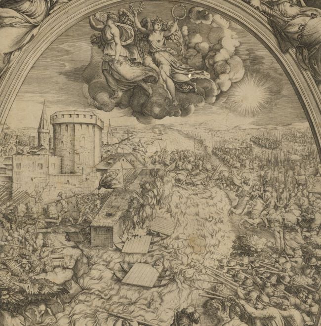
A high oblique view of Gotha, held by General Wilhelm von Grumbach (1 June 1503-18 April 1567) for John Frederick II, Duke of Saxony (8 January 1529-19 May 1595), besieged from 25 January to 17 April 1567 by Augustus, Elector of Saxony (31 July 1526-11 February 1586), resulting in the capitulation of the town. The Grumbach Feud (1567). Oriented with east (Leuante) to top.
John Frederick had sought to depose Augustus as Elector of Saxony but, by surrendering Gotha, his General, Grumbach, brought an end to these ambitions and also an end to himself – he was executed at Gotha on 18 April 1567, while John Frederick was imprisoned for the rest of his life.
The moated and fortified city of Gotha with Grimmenstein Castle occupied the centre of the view; the buildings, walls, and details of the fortifications are shown in some detail. The town of Erfurt is on the horizon, with Hochaim to the north, Muhlberg to the south-east, and Eisenach to the south-west. A woman with a child on her back and a dog on a lead is being directed by a scimitar-wielding soldier near Ellenben. Saxon troops are digging a trench to the west of the city.
Nicolo Nelli (b.1530, active 1562-74) (engraver) [bottom right, at foot of text panel, partly erased and not entirely legible:] Nicolo Nelli Venet F. 1567
Watermark: Indistinct device in circle. On backing paper: a cross in a drop-shaped circle, a crown above, below the Greek letters ΑΩ / M.
Condition: brown discolouration from the adhesive which was used to lay the print down on the backing paper; top left corner of mount cut off; formerly in poor condition with tears to the body of the print and abrasions which were repaired by laying the print down on paper before mounting; an impression from an item which was kept below this map/view is present on the verso, and more faintly apparent on the recto
30.7 x 41.2 cm (image and sheet)
cropped (platemark)
37.8 x 51.4 cm (mount)
Printed title:
GOTTA [top centre]
Additional text:
[bottom right, in a rectangular panel:] Alli 25 di Gennaro 1567 / su posto l'assedio sotto la gr / an fortezza di Griesteim / insieme con la citta di Gotta / dall' essercito del sacro Imperi / li quali luoghi furono dalli / Cittadinidati nelle mani del Com / issario dell' Imperio, alli. i3. / di Aprile, insieme con li rib / elli, et alli.17. furono secondo / i loro demeriti giusticiati.
Annotations:
George III heading: Gotha taken by Augustus Elector of Saxony in the operations against Grumbach and John Frederic, Duke of Saxony, 13 April 1567.
Other annotations: (Recto) [left, above old heading, on mount and bottom right, black pencil, erased, old heading notes?] (Verso) [top left, across mount and map, red pencil:] 1/42; [top left, on mount, black pencil:] I/43; [top right, on mount, black pencil, erased:] Gotha.
George III catalogue entry:
Gotha A Plan of Gotha taken by Augustus Elector of Saxony in the proceedings against Grumbach and John Frederic Duke of Saxony, 13.th of April 1567: by Nic. Nelli, 1567.
Subject(s)
Gotha, Thuringia, Germany (50°56ʹ53ʺN 10°42ʹ06ʺE)
Bibliographic reference(s)
G. Sale et al, An universal history: from the earliest accounts to the present time, vol. 30, Virginia 1761, p. 82
M. McDonald, The Print Collection of Cassiano dal Pozzo. Part II, Architecture, Topography and Military Maps, 3 vols, London 2019, cat. no. 2695
Page revisions
25 May 2024
Current version


