Contemporary maps of 10 sixteenth-century wars
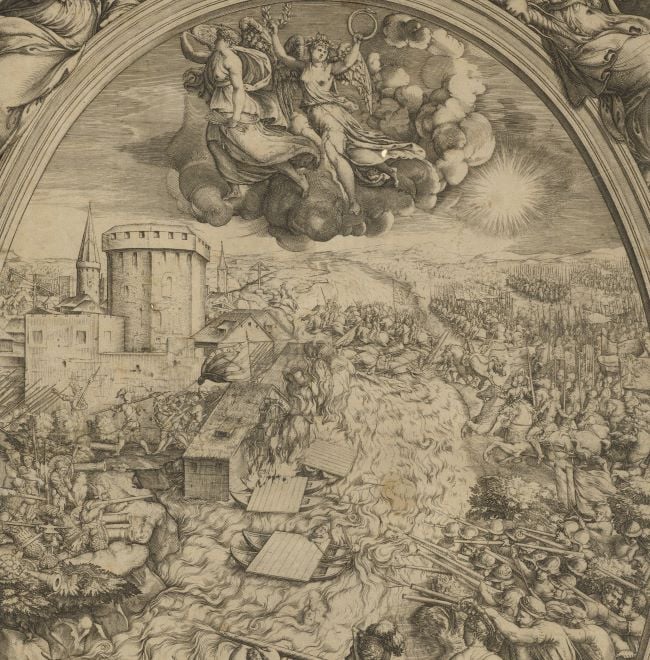
View of the siege of Calais, 1558 (Calais, Nord-Pas-de-Calais, France) 50°57ʹ07ʺN 01°51ʹ22ʺE)
1558 or laterEngraving; printed on paper; mounted on paper (Mount Type B); gilt edge, right | 26.0 x 35.5 cm (image and neatline) | RCIN 721025
A middle/high oblique view of the siege of the English town of Calais, commanded by Thomas Wentworth, 2nd Baron Wentworth (1525-13 January 1584) between 2 and 7 January 1558 by the French, commanded by Francis, Duke of Guise (17 February 1519-24 February 1563), resulting in a French victory. The last Valois-Habsburg War (1547-1559). Oriented with north to top.
See RCIN 721024 for details of the siege and the topography of the area. Like RCIN 721024, this print shows the taking of the Rysbank tower and the Calais castle, although on this view the French troops are entering the fort from the west, rather than from the north. The marshy terrain surrounding Calais is shown to better effect on this print.
Anonymous (cartographer)
Subject(s)
Army-Duke of GuiseArmy-SpainWatermark: Tulip in circle, six-pointed star above [see Woodward nos 120-135]
Condition: two fold lines; cropped to edge of image; a tear (some detail missing) along the bottom of the vertical fold line has been repaired; pressure marks are present along the top and bottom of the mount from mounted items which were placed above/below this item in a former collection
26.0 x 35.5 cm (image and neatline)
cropped (platemark)
44.4 x 39.9 cm (sheet)
Printed title:
CHALES [top centre, in a banner]
Additional text:
[bottom right, in a rectangular cartouche decorated with strapwork, a key, A-I, K-O, to the forts, roads, ditches, buildings, etc.]
Annotations:
George III heading: Calais taken from the English by the Duke of Guise 10. Jan.y 1558.
Other inscriptions: (Verso) [right, red pencil:] 1/22; [top right, black pencil, cropped:] I/25; [top left, black pencil, erased:] Calais.
George III catalogue entry:
Calais Plan of Calais, taken from the English by the Duke of Guise, Jan.y 10.th 1558.
Subject(s)
Calais, Nord-Pas-de-Calais, France (50°57ʹ07ʺN 01°51ʹ22ʺE))
Bibliographic reference(s)
M. McDonald, The Print Collection of Cassiano dal Pozzo. Part II, Architecture, Topography and Military Maps, 3 vols, London 2019, cat. no. 2658
Page revisions
25 May 2024
Current version


