Contemporary maps of 10 sixteenth-century wars
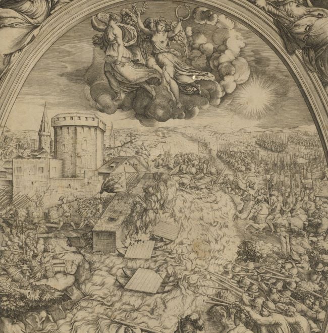
View of the siege of Polotsk, 1579 (Polotsk, Vitsyebskaya Voblasts’, Byelorussia) 55°29ʹ16ʺN 28°47ʹ08ʺE
published 1580Etching and engraving; printed on paper; the ink framing lines of Mount Type A have been drawn directly onto the sheet; gilt edges, left, bottom and right | 26.0 x 38.7 cm (image and platemark) | RCIN 721074
A high oblique view/map of the successful siege of Russian-held Polotsk, 9-29 August 1579, by the combined armies of the Polish-Lithuanian Commonwealth, commanded by King Stefan Báthory (27 September 1533-12 December 1586). Second Livonian War (1579-82). Oriented with south to top.
Polotsk, situated on the banks of the River Dvina, was well garrisoned but its fortifications, made of wood, were not strong. After fierce fighting, Stefan entered the town on 1 September. His 40,000 troops included Germans, Polish, Hungarian, Wallachian and Bohemian soldiers. This view shows the position of the army before 1 September. The camps, cavalry and infantry and munitions of the Polish and German troops can be seen, top left. The Lithuanian and Hungarian cavalry are bottom right (the standards flying from the Hungarian cavalry are the emblems of King Stefan), together with Polish infantry and Hungarian and Polish munitions. King Stefan’s sudden attack on Polotsk took Ivan IV (The Terrible; 15 August 1530-28 March 1584) of Russia off guard, and he, together with his generals, were unable to get to the town in time to relieve it.
The draughtsman of this map, Stanislaw Pachołowiecki, was King Stefan’s secretary and topographer and this map is considered to be the first Polish military map.
Stanislaw Pachołowiecki (active 1579-1581) (draughtsman) [top right, bottom of text cartouche, following on from text:] Delineauit in ipsis Castris S Pacholowic
Giovanni Battista de Cavalieri (c. 1525-1601) (engraver) [bottom centre, below text, first words are faint and barely legible:] [Ioannis Battista de Cavallerijs] Romæ tipis æneis incidebat Anno Domini i580
Subject(s)
Army-GermanyArmy-PolandArmy-HungaryArmy-LithuaniaWatermark: Boat in a circle
Condition: one fold line; a crisp image pulled from an unworn plate; not trimmed; pressure marks from the mounts of items which were kept above and below this print in a different collection are present on the recto and verso.
26.0 x 38.7 cm (image and platemark)
40.7 x 54.5 cm (sheet)
Printed title:
OBSIDIO ET EXPVGNATIO MVNITISS ARCIS POLOCENSIS PER SERENISS STEPHANVM POLONIAE REGEM [across top of print, within neatline]
Additional text:
[in a cartouche, top right:] OBSESSA XI AVG / CAPTA XXIX EIVSD / ANNO ·M·D·LXXIX [in a panel below the view:] POLOTIA · EX DVABVS ARCIBVS SVPERIORE AC SCLOPETARIORVM OPPIDOQ ZAPOLOTA CONSTANS ITA SITV LOCI / PROPVGNACVLIS AC INPRIMIS · BOMBARDARVM APPARATV PVLVERE GLOBIS COMMEATV MILITVM PRAESIDIO MV= / NITA ET INSTRVCTA VT MERITO NON SOLVM MOSCHOVIAE SED TOTIVS SEPTEMTRIONIS FIRMISSIMVM PROPVGNACVLVM / EXISTIMARETVR OBSESSA A SERENISS POLONIÆ REGE STEPHANO ·XI· AVGVSTI ET MOSCHIS STRENVE DEFENDENTIBVS EREPTA ·XXIX·EIVSD·ANNO DOMINI M D LXXIX
Annotations:
George III heading: Polotzk 1579.
Other annotations: (Recto) [bottom right, black pencil:] 1579; [left, on mount, black pencil:] 1579. (Verso) [top left, red pencil:] 1/67; [top left, black pencil, erased:] I/71; [top right, black pencil, erased and very faint:] [Politia].
George III catalogue entry:
Polotzk Obsidio et Expugnatio Arcis Polocensis per Stephanum Poloniæ Regem, obessa 9 Aug. capta 29 ejusdem 1579: a S. Pacholowic, sculpta a I.B. de Cavaleriis, 1580.
Subject(s)
Polotsk, Vitsyebskaya Voblasts’, Byelorussia (55°29ʹ16ʺN 28°47ʹ08ʺE)
Bibliographic reference(s)
I. Madariaga, Ivan the Terrible, London 2008, not paged
M. McDonald, The Print Collection of Cassiano dal Pozzo. Part II, Architecture, Topography and Military Maps, 3 vols, London 2019, cat. no. 2721
Page revisions
25 May 2024
Current version


