Contemporary maps of 10 sixteenth-century wars
View of the siege of Dieppe and the Battle of Arques, 1589 (Dieppe, Upper Normandy, France) 49°56ʹ00ʺN 01°05ʹ00ʺE; (Arques-la-Bataille, Upper Normandy, France) 49°52ʹ52ʺN 01°07ʹ43ʺE
dated 1589Engraving and etching; printed on paper; ink framing lines of Mount Type A are drawn directly onto the sheet; gilt edges, left, bottom and right | 34.7 x 45.9 cm (image) | RCIN 721079.b
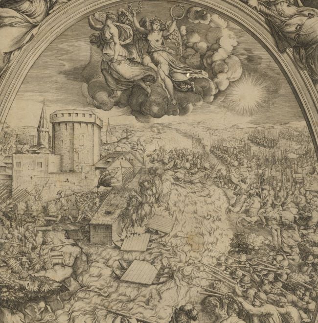
A view, looking north-west, of the Battle of Arques, fought 15-18 September 1589 between the armies of France with England, commanded by the Protestant Henry IV of France (13 December 1553-14 May 1610), and the Catholic League, under Charles of Lorraine, Duke of Mayenne (also known as Charles de Guise; 26 March 1554-3 October 1611), resulting in an Anglo-French victory. Eighth War of Religion (1585-9).
Henry IV, realising that Dieppe could not be defended, had moved his army four miles back to the little town of Arques, shown in this view in the bottom centre foreground, numbered ‘26’. The view, which is very foreshortened, does not depict the topography with any accuracy, save for the River Bethune, flowing fast through the centre and around Dieppe and into the sea. The impassable marshlands to each side of the river and its braided channels, and woods and steep defile east of Arques cannot be made out. The small church, shown a little way above and to the right of Arques in this view, may be the leper hospital, or Chapel of La Maladerie around which Henry built a broad trench and earthwork, perhaps the one shown in this view.
The Duke of Mayenne’s forces included a large contingent from Flanders who had been sent by the Duke of Parma (Alessandro Farnese, Governor of the Spanish Netherlands) and also Catholic Swiss and Landsknechts (German mercenaries); the Landsknechts are shown top right of this view. Although the battle took place on 21 September, the Duke of Mayenne’s forces were in the Dieppe area, attacking the town and manoeuvring from 13th September.
This print is struck from a worn plate: the lettering at the top and bottom are very faint. A crisp image is in the National Library of France (BnF GED-27343(RES)). The date of 1588 in the old heading appears to be an error for 1589.
Giovanni Battista de Cavalieri (c. 1525-1601) (engraver) [bottom right, below text:] Intagliata per Giouanbatista de Cauallerij in Roma l’anno i589.
Subject(s)
Army-FranceWatermark: None visible
Condition: one fold line; brown discolouration; some foxing; pressure marks from the mounts of items which were kept above and below this print in a different collection are present on the recto and verso
29.0 x 45.9 cm (neatline)
34.7 x 45.9 cm (image)
35.3 x 46.7 cm (platemark)
39.9 x 54.8 cm (sheet)
Printed title:
None
Additional text:
[bottom, below view, a key, 1-17:] Descritione della Terra, et Castello di Dieppa, assediata dal Sig.r Duca d’Humena [and, bottom right, below view, another key, 18-31:] Descritione dell’ esercito de Catolici accampato tra il Castello d’Arques et la Terra di Dieppa et batteria di 24 Canoni et. i2. Collumbrine.
Annotations:
George III heading: Dieppe besieged by the Duke of Mayenne 1588.
Other annotations: (Recto) [bottom right, black pencil:] 1589. (Verso) [top left, black pencil:] I/75; [top left, red pencil:] 1/71; [top right, black pencil, underlined but erased: a place name?].
George III catalogue entry:
Dieppe Descrittione della Terra et Castello di Dieppa, assediata dal Sig.r Duc d’Humena, et dell’ Esercito de Catolici accampato tra il Castello d’Arques et la Terra di Dieppa: intagliata per Giovanbatista de Cavalerii, 1589.
Subject(s)
Dieppe, Upper Normandy, France (49°56ʹ00ʺN 01°05ʹ00ʺE)
Arques-la-Bataille, Upper Normandy, France (49°52ʹ52ʺN 01°07ʹ43ʺE)
Bibliographic reference(s)
C. Oman, A history of the art of war in the sixteenth century, London, reprinted 1989, pp. 484-6
M. McDonald, The Print Collection of Cassiano dal Pozzo. Part II, Architecture, Topography and Military Maps, 3 vols, London 2019, cat. no. 2725
Page revisions
25 May 2024
Current version


