Ottoman-Habsburg Wars (1521-1791)
Images from eight wars fought between 1570 and 1718
View of the siege of Malta, 1565 (Malta, independent political entity) 35°55ʹ00ʺN 14°26ʹ00ʺE
published 1565Etching and engraving; printed on paper; mounted on paper (Mount Type B); gilt edges left, bottom and right | 33.6 x 43.1 cm (image and sheet) | RCIN 721039
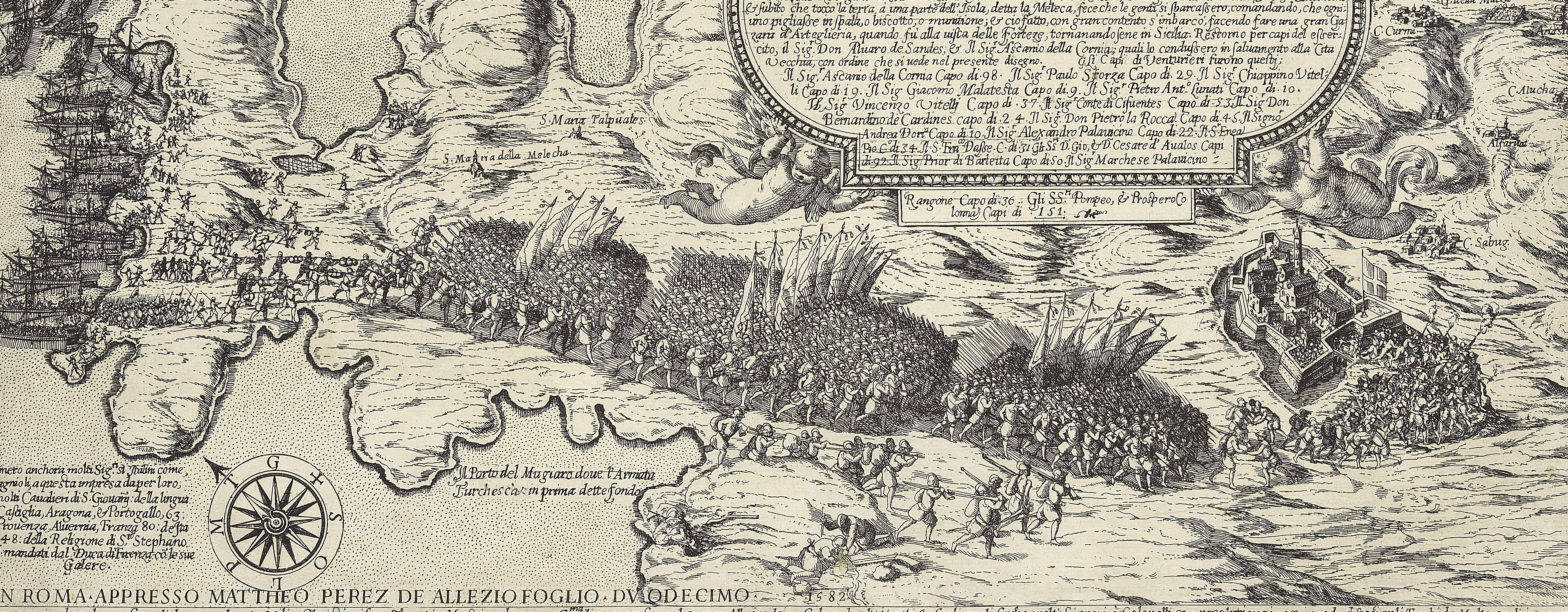
A high oblique view/map of the Great Siege of Malta between 18 May and 11 September 1565 carried on by the Turks, commanded by Kara Mustafa Pasha (c.1500-7 August 1580), and defended by the Knights of the Order of St John under Grand Master Jean Parisot de Valette (4 February 1495-21 August 1568), resulting in the abandonment of the siege by the Turks on the arrival of a Spanish fleet and army commanded by García Álvarez de Toledo, 4th Marquis of Villafranca (29 August 1514-31 May 1577). The Ottoman Empire (1500-1606): Conflicts in the Mediterranean (1532-1565). Oriented with north-west to top (compass rose).
A high oblique view of the whole island of Malta, with Gozo and the coasts of Sicily and Africa; Spanish, Portuguese and Italian troops have come to the relief of the Knights of St. John: the Turkish are retreating.
Domenico Zenoi (active 1560-80) (printmaker) [top right, at foot of title panel:] Domenico Zenoi Venetiano. f. ∞ DLXV
Subject(s)
Navy-TurkeyNavy-PortugalArmy-SpainArmy-ItalyArmy-TurkeyWatermark: Anchor in circle, six-pointed star above [see Woodward no. 174]
Condition: one fold line; creased; one fold line to mount, not coincident with the fold line of the map; top left corner cut off; small piece missing, bottom right corner; slight abrasions resulting in loss of paper thickness. Verso: some offsetting, perhaps from a different image
33.6 x 43.1 cm (image and sheet)
cropped (platemark)
41.4 x 54.8 cm (mount)
Printed title:
L'Vltimo disegno de l'jsola di Malta, con la / uera liberatione dell' jinimiche forze, quale dopo / l'hauer lunge tempo assediato & detto infiniti / Assalti alle forteze & d'esse la maggior parte / Rouinate si parte & fugge dalle mani dell' jniutiss.o / S.D. Cartia [followed by measurements of the island, and numbers of towns and castles.] [top right, in a rectangular panel]
Annotations:
George III heading: Malta 1565.
Other annotations: (Recto) none. (Verso) [top left, on map, red pencil:] 1/37; [top right, on mount, black pencil:] 1565; [top left, on mount, black pencil, erased:] II [or I]/38h.
George III catalogue entry:
Malta A Plan of the Island of Malta, with the defeat and retreat of the Turks: by Domencio Zenoi, 1565.
Subject(s)
Malta, independent political entity (35°55ʹ00ʺN 14°26ʹ00ʺE)
Bibliographic reference(s)
M. McDonald, The Print Collection of Cassiano dal Pozzo. Part II, Architecture, Topography and Military Maps, 3 vols, London 2019, cat. no. 2686
Page revisions
25 May 2024
Current version


