Ottoman-Habsburg Wars (1521-1791)
Images from eight wars fought between 1570 and 1718
View of the siege of Malta, 1565 (Malta, independent political entity) 35°55ʹ00ʺN 14°26ʹ00ʺE
published 1565Engraving and etching; printed on paper; mounted on paper (Mount Type B on verso); gilt edges left, bottom and right | 37.7 x 50.0 cm (image and sheet) | RCIN 721040
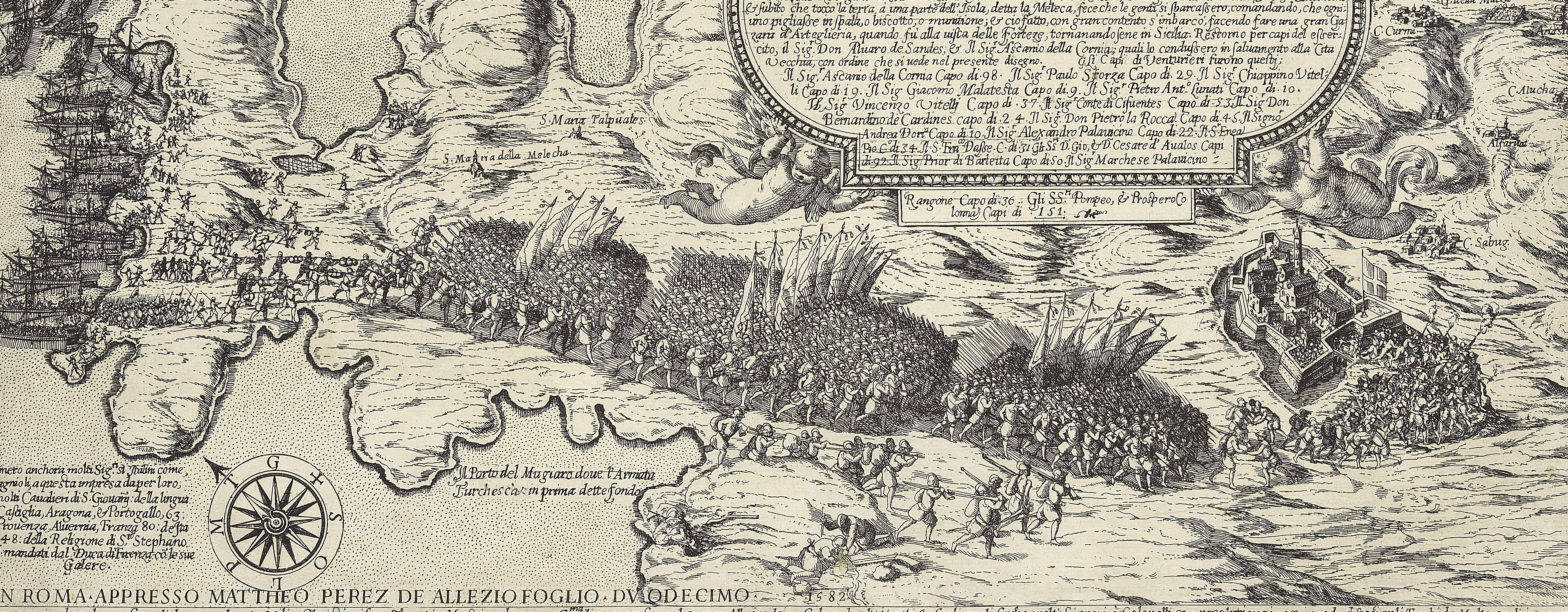
A high oblique view/map of the Great Siege of Malta between 18 May and 11 September 1565 carried on by the Turks, commanded by Kara Mustafa Pasha (c.1500-7 August 1580), and defended by the Knights of the Order of St John under Grand Master Jean Parisot de Valette (4 February 1495-21 August 1568), resulting in the abandonment of the siege by the Turks on the arrival of a Spanish fleet and army commanded by García Álvarez de Toledo, 4th Marquis of Villafranca (29 August 1514-31 May 1577). The Ottoman Empire (1500-1606): Conflicts in the Mediterranean (1532-1565). Oriented with south to top.
The whole island of Malta is shown together with Gozo and the coast of Africa and Sicily; Spanish, Portuguese and Italian troops have come to the relief of the Knights of St John: the Turkish are retreating.
This impression is taken from a re-worked plate: traces of a partly erased text panel are visible, top left. Examples of this map occur in Lafreri atlases.
Antoine Lafréry (1512-77) (publisher) [top right, at bottom of title panel:] Ant. Lafrerij Formis Romæ cum Priuilegio.
Subject(s)
Army-TurkeyNavy-TurkeyNavy-SpainWatermark: Pilgrim with vertical crook, in circle [see Woodward no. 5]
Condition: one fold line; top margin cropped. Verso: the mount has been made out of an old, or dis- or unused Mount Type A which was prepared for a smaller item; impressions from the mount of an item which was kept below this map in a former sequence
37.7 x 50.0 cm (image and sheet)
cropped (platemark)
39.5 x 54.6 cm (mount)
Printed title:
MELITA Insula Diui Pauli Apostoli / quondam hospita : nunc Militiæ Hierosolymitanæ / sedes : cum .cc. circiter triremium classe' maximis q / copijs à Turcis obsideretur: Philippi secundi / Hispaniarum Regis auspicijs, à Garsia Toledo / Siciliæ ... Idus Septembris, Anno Salutis. M·D·LXV· / Sedente et opitulante Pio Quarto Pont.Opt.Max. / Anno VI. [top right, in a rectangular panel]
Annotations:
George III heading: Malta 1565.
Other annotations: (Recto) [bottom right, black pencil:] 1565; [top left, black pencil, underneath K.Mil number:] I/[?]5. (Verso) [top right, on mount, black pencil:] 1565; [top left, red pencil, on map:] 1/[?] 34
George III catalogue entry:
Malta A Plan of the Island of Malta, with the defeat and flight of the Turks: by Antonio Lafreri.
Subject(s)
Malta, independent political entity (35°55ʹ00ʺN 14°26ʹ00ʺE)
Bibliographic reference(s)
M. McDonald, The Print Collection of Cassiano dal Pozzo. Part II, Architecture, Topography and Military Maps, 3 vols, London 2019, cat. no. 2687
R.V. Tooley, ‘Maps in Italian atlases of the sixteenth century, being a comparative list of the Italian maps issued by Lafreri, Forlani, Duchetti, Bertelli and others, found in atlases’, Imago Mundi III, 1939, pp. 12-47, no. 374
Page revisions
27 March 2025
Current version


