Ottoman-Habsburg Wars (1521-1791)
Images from eight wars fought between 1570 and 1718
View of the siege of Malta, 1565 (Malta, independent political entity) 35°55ʹ00ʺN 14°26ʹ00ʺE
c. 1565Engraving and etching; printed on paper; mounted on paper (Mount Type A); gilt edges left, bottom and right | 39.9 x 51.5 cm (image and sheet) | RCIN 721041
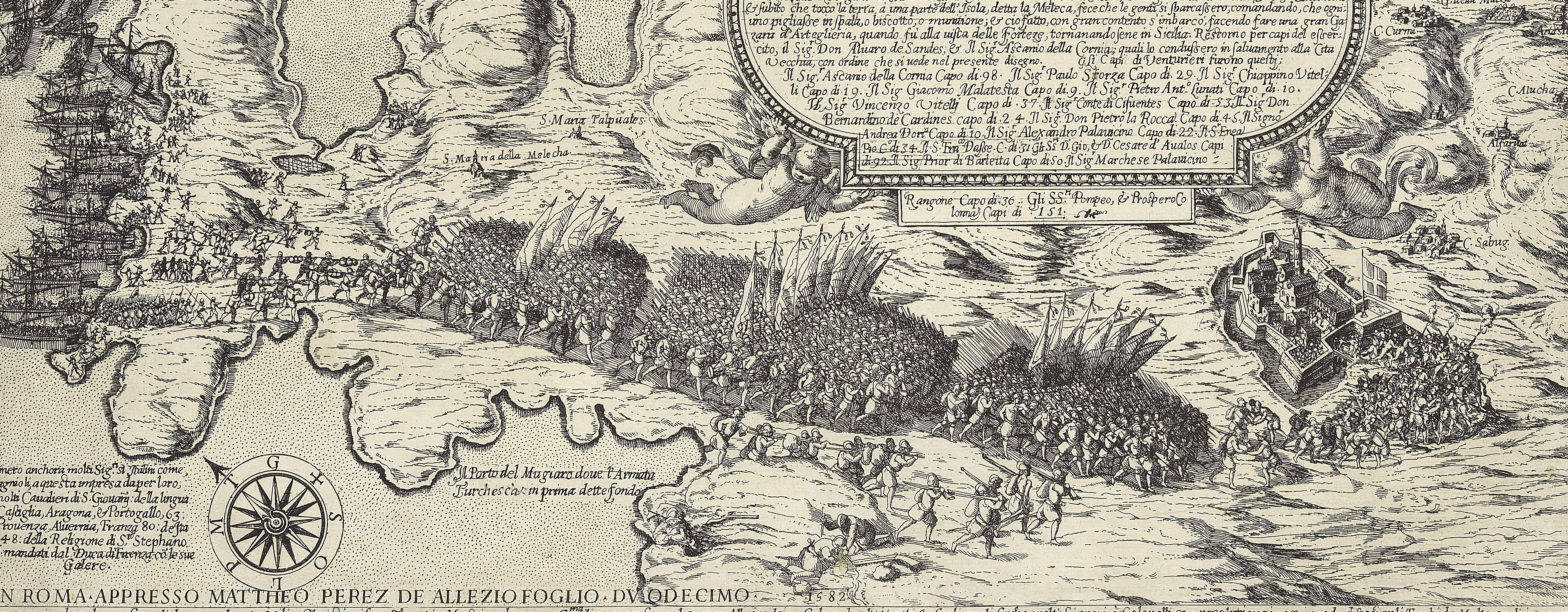
A high oblique view/map of the Great Siege of Malta between 18 May and 11 September 1565 carried on by the Turks, commanded by Kara Mustafa Pasha (c.1500-7 August 1580), and defended by the Knights of the Order of St John under Grand Master Jean Parisot de Valette (4 February 1495-21 August 1568), resulting in the abandonment of the siege by the Turks on the arrival of a Spanish fleet and army commanded by García Álvarez de Toledo, 4th Marquis of Villafranca (29 August 1514-31 May 1577). The Ottoman Empire (1500-1606): Conflicts in the Mediterranean (1532-1565). Oriented with north-east to top (cardinal points).
This view of the whole island shows the Turkish army and fleet in full retreat. The peninsula of St Elmo is shown as an island.
Not in Tooley (1939). Although the map shows the departure of the Turks from Malta in September 1565, it also shows the walls of the new city of Valletta. The formal decision to build the new fortified city was taken on 14 March 1566 (Hoppen, p.32), and building was not advanced until 1568. It is possible that an earlier state of the map exists without ‘La noua citta’.
Pietro Paolo Palumbo (active 1563–?1586) : Rome (print seller) [top left, bottom of title panel:] Se uendeno a S.to Agostino a linsegna / della Palomba / In Roma Con gratia et priuilegio
Subject(s)
Army-TurkeyNavy-SpainNavy-TurkeyWatermark: Eagle in crowned circle [see Woodward nos 54-75]
Condition: one fold line; creased; brown staining; smudged ink; old repair to tear, left; small worm hole right of centre. Verso: old repair to a complex tear, right; some offsetting from a different image, top left; offsetting from ink framing lines from another mounted item; ink framing lines on the mount, drawn for a smaller item.
39.9 x 51.5 cm (image and sheet)
cropped (platemark)
41.2 x 54.9 cm (mount)
Printed title:
Nuouo et ultimo disegno di Malta hauuto / da li auisi delli xiiij et xix di Settembre / doue si uede illuocho nel quale l'Eccettmo / Sor D. Garzia sbarcoi soldati et la Vittoria / loro, et fuga de larmata Turchesca, [top left, in a rectangular panel]
Additional text:
[top right, in a rectangular panel, a key 2-12 (?1 cropped); 8 is partly erased and has no place-name against it.] [bottom left, in a rectangular panel, a key, A-I, K-M:] Le cose notabile seguite ne l'isola si dimostrano / col presente Alfabetto
Annotations:
George III heading: Malta 1565.
Other annotations: (Recto) [top left, black pencil, underneath K.Mil number:] I/[?]6 (Verso) [bottom right, on map, red pencil:] 1/35
George III catalogue entry:
Malta Disegno di Malta havuto dal avisi delli 14 et 19 di Settembre, dove si vede il luocho nel quale D. Garzia sbarcoi Soldati et la Vittoria loro et fuga de l’Armata Turchesca.
Subject(s)
Malta, independent political entity (35°55ʹ00ʺN 14°26ʹ00ʺE)
Bibliographic reference(s)
A. Hoppen, The fortification of Malta by the Order of St. John, Edinburgh 1979
M. McDonald, The Print Collection of Cassiano dal Pozzo. Part II, Architecture, Topography and Military Maps, 3 vols, London 2019, cat. no. 2688
R.V. Tooley, ‘Maps in Italian atlases of the sixteenth century, being a comparative list of the Italian maps issued by Lafreri, Forlani, Duchetti, Bertelli and others, found in atlases’, Imago Mundi III, 1939, pp. 12-47
Page revisions
23 May 2024
Current version


