Contemporary maps and prints of the major battles and sieges from 1635 to 1658
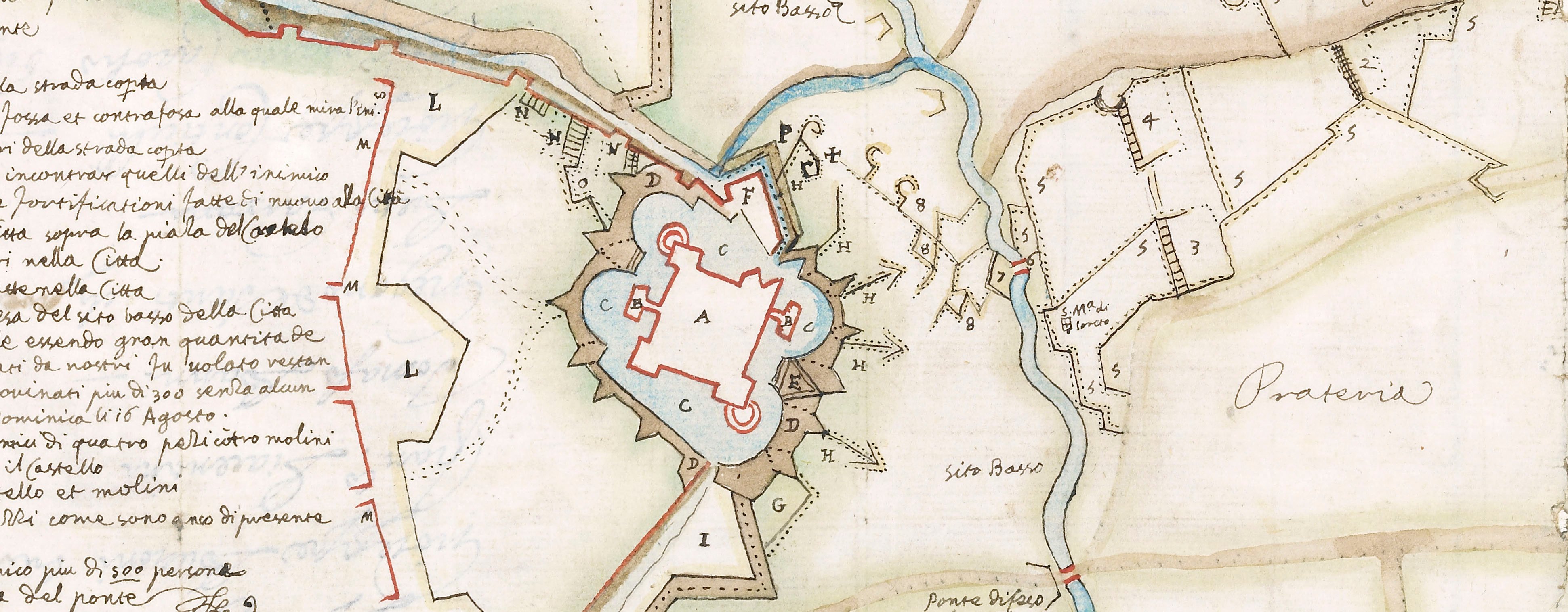
Map of Alessandria, 1657 (Alessandria, Piedmont, Italy) 44°54ʹ33ʺN 08°36ʹ36ʺE
published 1657Etching; printed on paper; contemporary? manuscript additions in red ink; mounted on paper (Mount Type B); gilt edges recto and back | 29.8 x 41.1 cm (neatline) | RCIN 723113
This town plan shows the city of Alessandria to the south-west of the River Tànaro and the the Borgo, with its citadella, on the opposite river bank. No military details are engraved on the print; these are supplied in what may be contemporary manuscript and show the circumvallation which was constructed during the siege of the city by French troops from 17 July 1657, commanded by Francesco I d'Este, Duke of Modena (1610-58). The city was recaptured on 19 August by Spanish forces commanded by Charles II Duke of Mantua and Alfonso Pérez de Vivero Count of Fuensaldaña and governor of Milan (1603-61). Franco-Spanish War (1635-59). Oriented with north-west to top.
The manuscript annotations give the following names (SW to SE): 'Campo é quar.o del / Ser.mo Dca di Modena'; 'G.ra di Moda'; 'D.ca di Modena'; Campo é quar.o delli / P.e bolso é Almerigo'; 'Campo et quar.o / della Caual.o del Conte / Baiarrdo'; 'P. di Conti'; 'P.e di Conti'; 'Campo é quar.o / del P.e di Conti'.
The scale of the town is greatly enlarged compared with the scale of the details of the surrounding country. The main settlements around the periphery of the print are, from west through north to south: Aste (Asti 44°53ʹ53ʺN 08°12ʹ25ʺE), Casal (Casale Monferrato 45°08ʹ00ʺN 08°27ʹ09ʺE), Valenza (45°00ʹ45ʺN 08°38ʹ38ʺE), Tortona (44°53ʹ52ʺN 08°51ʹ49ʺE) and Gomalerio (Gamalero 44°48ʹ33ʺN 08°32ʹ30ʺE).
François Collignon (c.1610-87) (etcher and print seller) [bottom left, below key:] fran.co Collignon sculpsit Roma nel anno 1657. Si / Vende in botega sua nel Parione incontro al Toson
Watermark: Map: bird in circle. Mount: none.
Condition: one fold line to mount. Verso: some foxing to bottom edge of mount; pencil guide lines for cutting the window of the mount to each corner of the window; the red ink has migrated through to the verso. Pressure marks from the mounts of items which were kept above and below this map/print in a different collection are present on the recto and verso
29.8 x 41.1 cm (neatline)
cropped (platemark)
29.8 x 41.1 cm (sheet)
40 x 52.4 cm (mount)
Printed title:
ALESSANDRIA [No title. Lettering on map, bottom centre]
Additional text:
[bottom left, in rectangular panel, a key, A-I, K-T, V, X-Z and 1-10 to the principal buildings, gates and fortifications.]
Annotations:
George III heading: Alessandria besieged by the Duke of Modena and the Prince of Conti. 17 July – 18 August 1657.
Other annotations: (Recto) [on face of map, red ink, in a contemporary? hand, the outer ring or circumvallation of siege fortifications annotated with the names of different officers’ encampments. (Verso) [top left, black pencil:] III/134.
George III catalogue entry:
Alessandria A Plan of Alessandria besieged by the Duke of Modena and the Prince of Conti from the 17.th of July to the 18.th of August 1657
Subject(s)
Alessandria, Piedmont, Italy (44°54ʹ33ʺN 08°36ʹ36ʺE)
Bibliographic reference(s)
M. McDonald, The Print Collection of Cassiano dal Pozzo. Part II, Architecture, Topography and Military Maps, 3 vols, London 2019, cat. no. 3231
Page revisions
25 May 2024
Current version


