Contemporary maps and prints of the major battles and sieges from 1635 to 1658
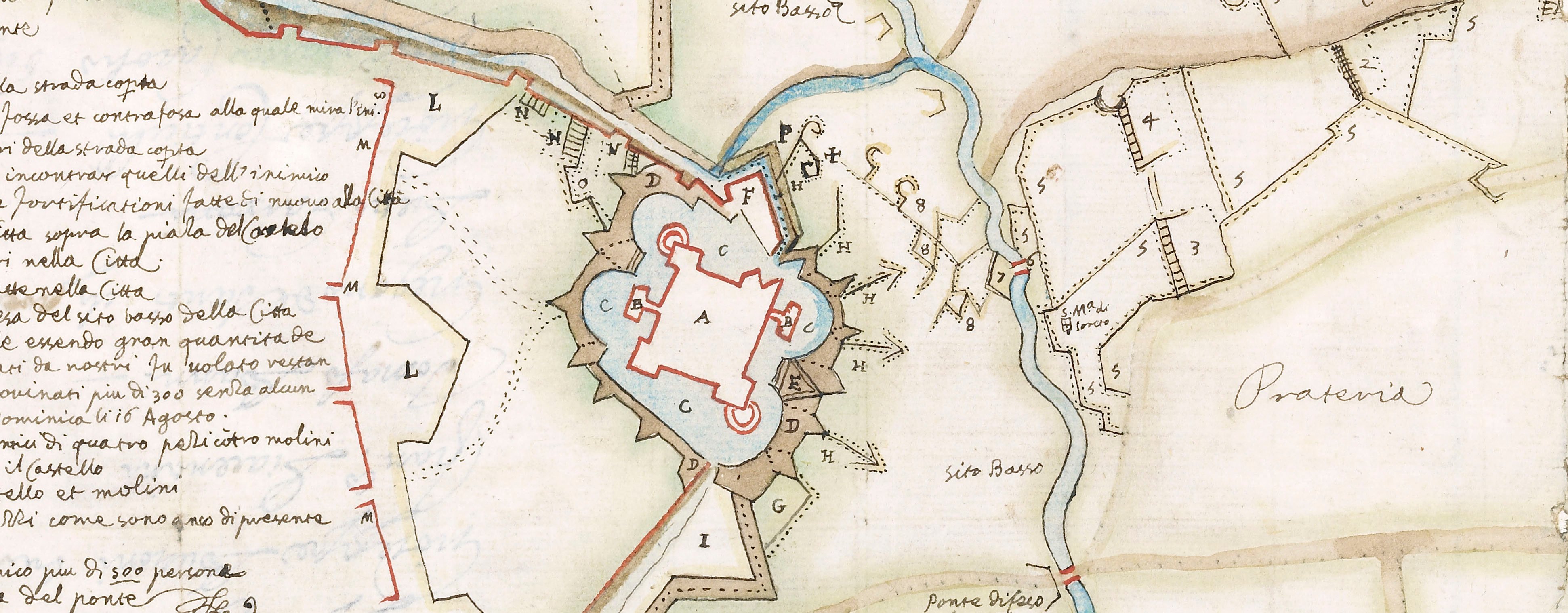
Map of the siege of Aire, 1641 (Aire-sur-la-Lys, Nord-Pas-de-Calais, France) 50°38'19"N 02°23'55"E
1641 or laterTwo columns of letterpress text, each comprising two pieces of text, joined, and mounted on one sheet of paper (Mount Type B); gilt edges right and bottom | 334.0 x 13.3 cm (sheet of left column) | RCIN 723005.b
Accompanying letterpress text to the map of the siege of Aire, 1641 (see RCIN 723005.a). Franco-Spanish War (1635-1659).
Nicolaes Visscher I (1618-79) (printer) [at end of text:] A AMSTERDAM, / Imprimé chez Nicolas Ieansz. Visscher, demeurant en la Calverstrate.
Subject(s)
Army-FranceWatermark: Text: cropped: part of a jug [and, cropped:] a flower. Mount: none.
Condition: no fold lines; slight pressure marks
34.0 x 13.3 cm (sheet of left column)
34.0 x 13.3 cm (sheet of right column)
40.2 x 52.0 cm (mount)
Printed title:
Briefve Representation de l’Assiette de la Forte ville / d’AIRE, ensemble son Siege de l’an 1641.
Annotations:
George III heading: Aire 19 May – 26 July 1641.
Other annotations: none.
George III catalogue entry:
Aire Plan d’Ayre avec ses Forts, Lignes de Circonvalation et attaques de la Ville, assiegée par Louis XIII le 19 May et prise le 26 Juillet 1641: chez Visscher avec une Description.
Subject(s)
Aire-sur-la-Lys (Nord-Pas-de-Calais, France) 50°38'19"N 02°23'55"E
Bibliographic reference(s)
M. McDonald, The Print Collection of Cassiano dal Pozzo. Part II, Architecture, Topography and Military Maps, 3 vols, London 2019, cat. no. 3090, 3091
Page revisions
23 May 2024
Current version


