Contemporary maps and prints of the major battles and sieges from 1635 to 1658
View of Crescentino, 1638 (Crescentino, Piedmont, Italy) 45°11ʹ26ʺN 08°06ʹ00ʺE
1638 or laterEtching and engraving; printed on paper; mounted on paper (Mount Type B); gilt edges top and right | 30.4 x 21.4 cm (image and sheet) | RCIN 722127
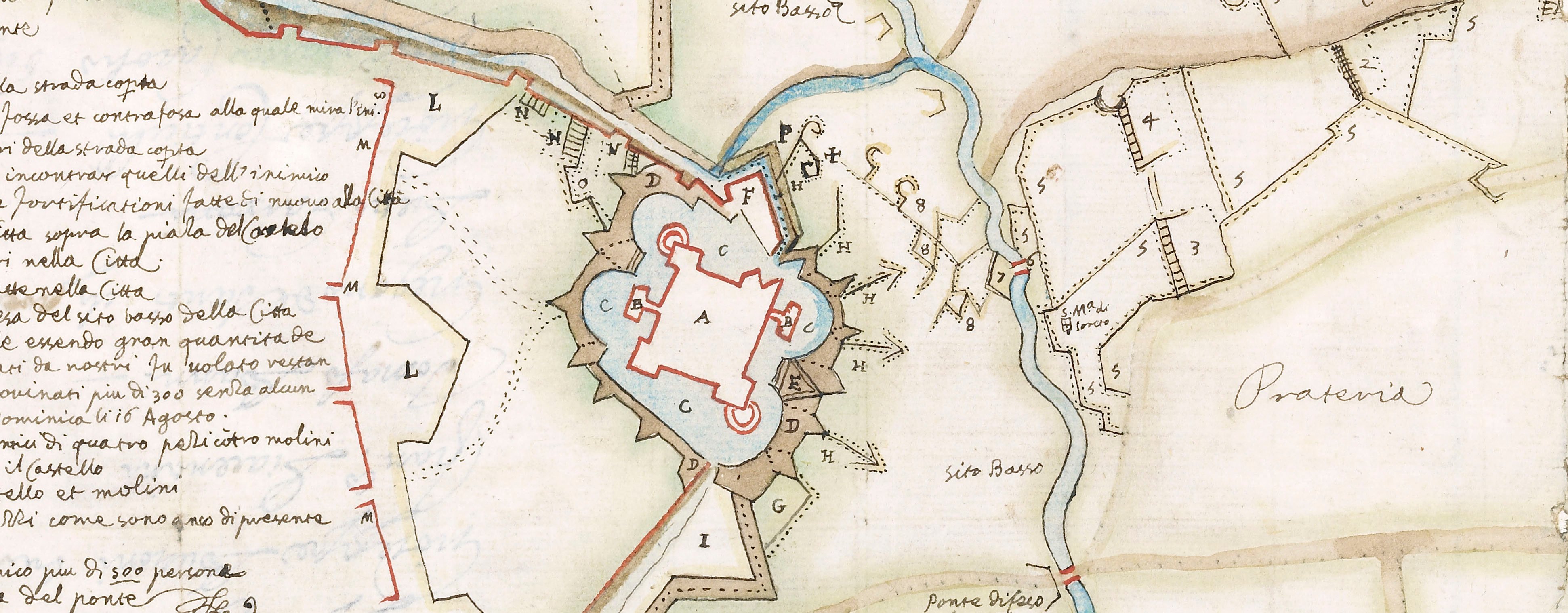
A high oblique view/map of Crescentino, taken by the Spaniards on 11 April 1638 by Diego Felipez de Guzmán, 1st Marquis of Leganés (1580-1655), Governor of Milan. Franco-Spanish War (1635-1659). Oriented with west to top.
This print shows the positions of the encampments of the besieging allied Spanish, Italian and German forces together with the approach works. The dashed lines along the southern (left) fortified walls of the town were incomplete and abandoned by the French, who were defending the fort. According to the title text, the town of 'Veruva' (Verrua Savoia 45°09ʹ24ʺN 08°05ʹ32ʺE) had been taken on the 10 April, the day before the capitulation of Crescentino.
Anonymous (printmaker)
Subject(s)
Army-SpainArmy-ItalyArmy-GermanyWatermark: Map: none visible. Backing paper: bird [goose?] in circle, an ‘S’ above. Mount: cropped, part of a shield.
Condition: one fold line; brown discolouration; foxing; torn, top right corner. Verso: pressure marks from a mount with four columns of text
30.4 x 21.4 cm (image and sheet)
cropped (platemark)
50.7 x 40.5 cm (mount)
Printed title:
Crescentino si rese alli 11. Aprile, uscendone 450. Frācesi con la solo Spada, quali sono stati conuoiati / a Genoua per imbarcarsi, et passare in Francia. / Veruua la terra fu presa dal S.D. Gio: de Garrai p assalto li 10 Aprile, il Castello si rese poco doppo a’ patti, / uscendone da quella 250 diffensori Francesi, quali furono parimente inuiati in Francia, per la uia di Genoua. [bottom, below view]
Additional text:
[top right, in rectangular panel, a key, A-I, L-P.]
Annotations:
George III heading: Crescentino taken by the Spaniards under the command of the Marquis de Leganes on the 11.th of April 1638.
Other annotations: (Recto) [top, red pencil:] taken by [?] in 1637. (Verso) none.
George III catalogue entry:
Crescentino A Plan of Crescentino taken by the Spaniards under the command of the Marquis de Leganes on the 11.th of April 1638.
Subject(s)
Crescentino, Piedmont, Italy (45°11ʹ26ʺN 08°06ʹ00ʺE)
Bibliographic reference(s)
M. McDonald, The Print Collection of Cassiano dal Pozzo. Part II, Architecture, Topography and Military Maps, 3 vols, London 2019, cat. no. 3030
Page revisions
25 May 2024
Current version


