Contemporary maps and prints of the major battles and sieges from 1635 to 1658
View of the siege of Casale Monferrato, 1652 (Casale Monferrato [Casale, Casal, Cazal], Piedmont, Italy) 45°08ʹ00ʺN 08°27ʹ09ʺE
published 1652Etching and engraving; printed from six copperplates on six sheets of paper, then joined. Traces of Type B mounts. | Scale not stated | RCIN 723096.a
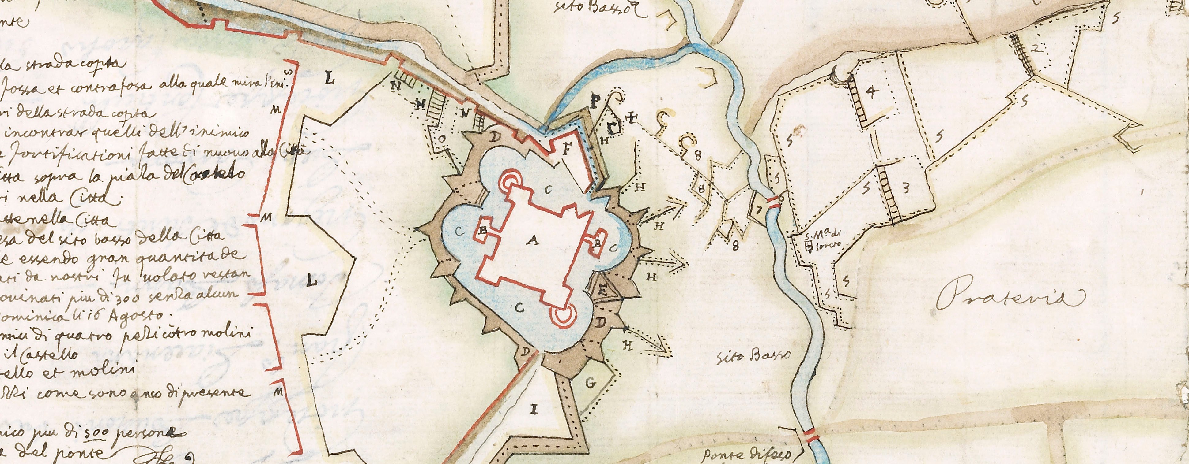
A high oblique view of Casale Monferrato, besieged in July 1652 and captured in October by the Spanish army of Milan commanded by Luis Francisco de Benavides Carillo de Toledo, Marqués de Caracena, Governor of Milan (20 September 1608-6 January 1668). Franco-Spanish War (1635-1659). Oriented with east-north-east to top.
This large-scale map shows the city in outline only with the details of the fortified walls; the lines of circum- and contravallation are drawn with apparent precision and the positions of the encamped besieged forces in relation to them is indicated. A great effort has been made to portray the surrounding landforms and landuse as well as the lines of communication.
Features are not named but the explanation to the numbers is given in the accompanying letterpress text at RCIN 723096.b. The pieces of this text have not been pasted together in a logical order.
Pierre de Loisy II (1619-70) (etcher) [bottom right:] P. De Loisy Borgondus. Fe / Mediol. ano. 1653
? Anonymous (publisher)
Watermark: None
Condition: nine fold lines
Scale not stated
96.0 x 110.8 cm (image and sheet)
32.3 x 48.8 cm (platemark of top left sheet)
32.3 x 52.3 cm (platemark of top centre sheet)
36.4 x 48.9 cm (platemark of top right sheet)
36.8 x 52.5 cm (platemark of bottom left sheet)
27.8 x 48.7 cm (platemark of bottom centre sheet)
28.0 x 53.0 cm (platemark of bottom right sheet)
Printed title:
DESCRITTIONE DELL’ ASSEDIO DI CASAL MONFERRATO, / Con sua circonualatione, & contrafosso / espugnationi del Castello, e Citta della d’essa, conseguito da S.E. il Sig. Marchese di Caracena, Gouernatore per Sua Maestà / Cattolica nello Stato, di Milano, l’anno 1652. [title on letterpress text, at RCIN 723096.b]
Annotations:
George III heading: Casal besieged by the Marquis of Caracena in 1652
Other annotations: (Recto) [top left, black pencil:] 3 small circles. (Verso) [bottom right, black pencil and ink:] 8 small circles.
George III catalogue entry:
Casal Disegno dell’ Assedio di Casal Monferrato con sua Circonvalatione, et contrafosso, Espugnationi del Castello e Citadella d’essa, consequita dal Marchese di Caracena l’anno 1652: da P. de Loisy, 1653. 6 foglie. with a Description.
Subject(s)
Casale Monferrato [Casale, Casal, Cazal], Piedmont, Italy (45°08ʹ00ʺN 08°27ʹ09ʺE)
Bibliographic reference(s)
J. Israel, Conflicts of Empires: Spain, the Low Countries and the struggle for world supremacy, 1585-1713, London 1997, pp. 127-8
M. McDonald, The Print Collection of Cassiano dal Pozzo. Part II, Architecture, Topography and Military Maps, 3 vols, London 2019, cat. no. 3214
Page revisions
25 May 2024
Current version


