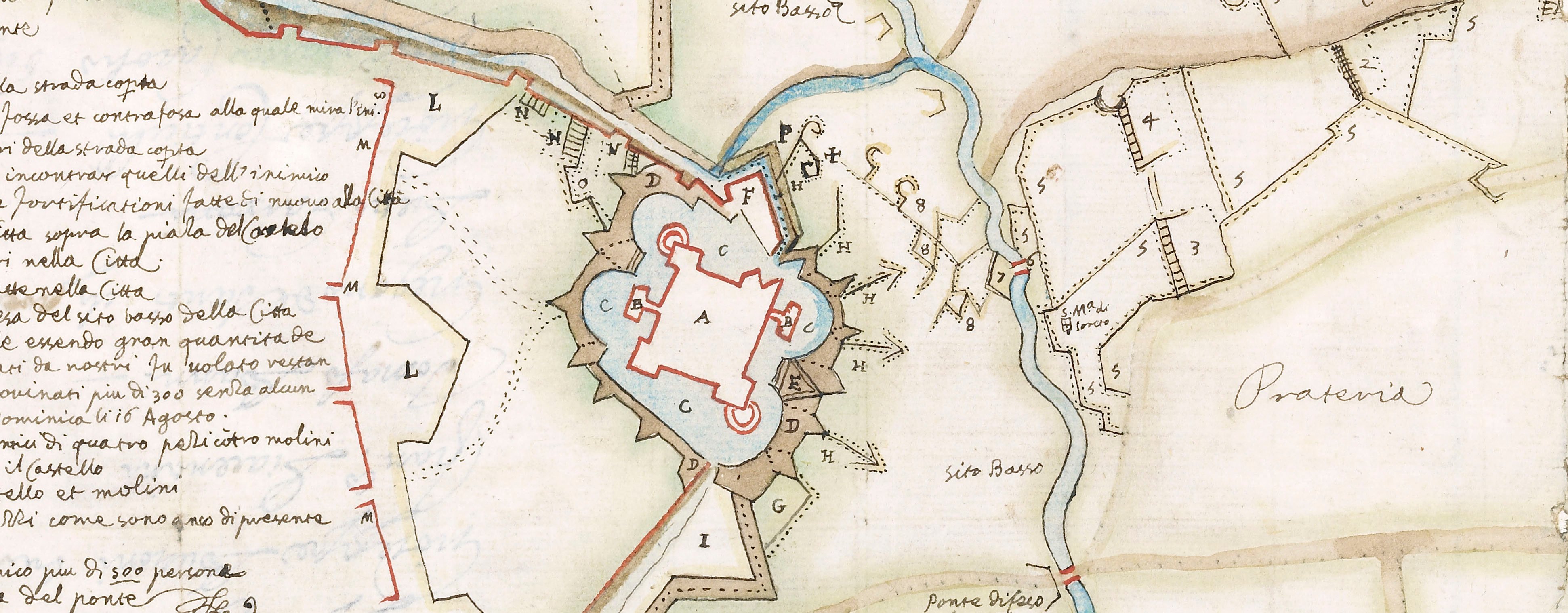
Contemporary maps and prints of the major battles and sieges from 1635 to 1658
Siege of Casale Monferrato, 1652 (Casale Monferrato [Casale, Casal, Cazal], Piedmont, Italy) 45°08ʹ00ʺN 08°27ʹ09ʺE
published 1652Letterpress text on four pieces of paper, joined to form two panels of text; mounted on paper (Mount Type B); with woodcut decorations | 16.2 x 48.5 cm (sheet of top row) | RCIN 723096.b
Letterpress text accompanying the map of the siege of Casale Monferrato, 1652 (see RCIN 723096.a). Franco-Spanish War (1635-1659).
Anonymous (artist)
Subject(s)
Army-SpainArmy-ItalyWatermark: Text: none. Mount: cropped, anchor and the letters L M in a circle.
16.2 x 48.5 cm (sheet of top row)
17.3 x 51.1 cm (sheet of bottom row)
34.7 x 50.9 cm (mount)
Printed title:
DESCRITTIONE DELL’ ASSEDIO DI CASAL MONFERRATO, / Con sua circonualatione, & contrafosso / espugnationi del Castello, e Citta della d’essa, conseguito da S.E. il Sig. Marchese di Caracena, Gouernatore per Sua Maestà / Cattolica nello Stato, di Milano, l’anno 1652.
Annotations:
George III heading: Casal 1652.
Other annotations: none.
George III catalogue entry:
Casal Disegno dell’ Assedio di Casal Monferrato con sua Circonvalatione, et contrafosso, Espugnationi del Castello e Citadella d’essa, consequita dal Marchese di Caracena l’anno 1652: da P. de Loisy, 1653. 6 foglie. with a Description.
Subject(s)
Casale Monferrato [Casale, Casal, Cazal], Piedmont, Italy (45°08ʹ00ʺN 08°27ʹ09ʺE)
Bibliographic reference(s)
M. McDonald, The Print Collection of Cassiano dal Pozzo. Part II, Architecture, Topography and Military Maps, 3 vols, London 2019, cat. no. 3215, 3216
Page revisions
5 June 2024
Current version


