French Revolutionary Wars (1792-1802)
Maps and prints of naval engagements collected by George III during the decade of war
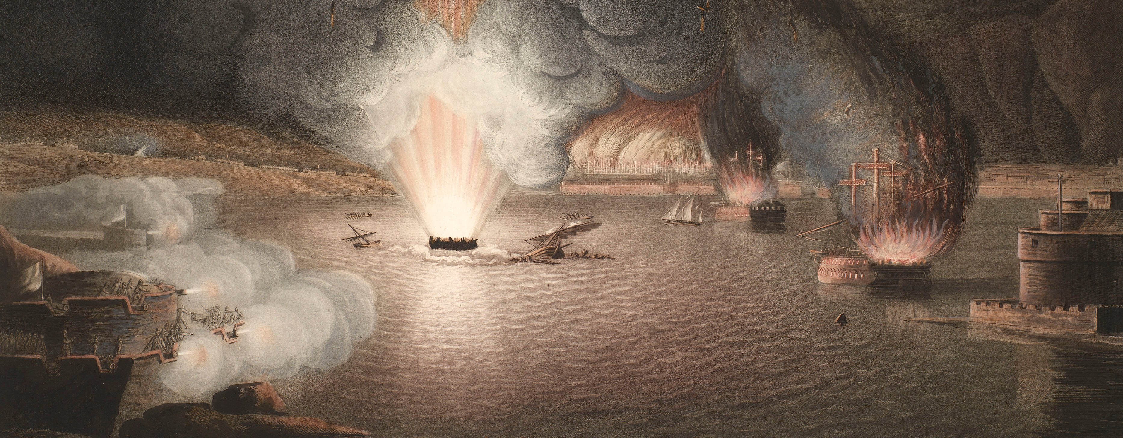
View of the Battle of Copenhagen, 1801 (Copenhagen, Denmark) 55°40'46"N 12°34'22"E
1801 or laterEngraving and etching; printed on paper; laid down on paper, the paper backing brought round the edges of the recto. An engraved key is attached to the left edge (see RCIN 735093.b). | 53.0 x 75.3 cm (image) | RCIN 735093.a
This example is probably a proof copy. The lettering of the title on this example of the print is in outline, and the lettering of the creators' names is also faint. Another state exists (RCIN 770115) with a dedication below the title: 'Kronprindsen af Dannemark og Norge &. &. &. underdanigst tilegnet' and with infilled title lettering. The creators' names are more strongly engraved and an additional inscription: 'af I.F. Clemens.' is engraved bottom right.
An engraved key to the view (RCIN 735093.b) is attached to the left edge.
This view is taken from a point somewhere along the present-day Langeliniebugten, looking over the Danish naval shipyard of Nyholm, north-north-east towards the raging battle. The Danish (in the foreground) and British ships are obscured by smoke and the sea is alive with the splashes of falling cannon balls. In the foreground, right of centre, are the main buildings of the arsenal. A large pile of ammunition can be seen through the arched entrance in the wall. To the right of these buildings, separated by a stretch of water, perhaps a canal, and along a strip of land, are two small roofed structures which are, according to the key, gunpowder towers on the Fordækte road to Quintus. This road may be the present-day Krudtløbsvej. At the northern end of that road is a structure resembling a mast with four cross bars. This was the Nyholm mast, one of the chain of signal stations which stretched along the coast from Kronborg. This mast stands on the Quintus battery. The tall building to the left of the two ships under construction in the middle foreground, is the Nyholm crane. The large building at the extreme left of the view is a warehouse which, according to the key, obscures a view of the water where there was, in any case, no action. Beyond the warehouse are two sea batteries. The larger of these is the Tekroner Fort, and the right hand battery is a small lunette.
It was at this battle that Vice-Admiral Sir Horatio Nelson famously ignored Rear-Admiral Sir Hyde Parker's order to withdraw, turning his blind eye to the signal and going on to destroy a number of enemy ships before a truce was agreed.
Condition: no fold lines; brown discolouration; 11 mm tear to centre of left edge; two tears, 14 mm and 11 mm to bottom edge; brown staining to bottom and right edge; surface dirt. Verso: substantial brown staining to bottom and left edges.
Johan Frederik Clemens (1749-1831) (engraver) [bottom right, below view:] I.F. Clemens Sculps.
After Christian Auguste Lorentzen (1749-1828) (artist) [bottom left, below view:] C.A. Lorentzen pinx.
Subject(s)
Hyde Parker (1739-1807)Royal NavyNavy-DenmarkHoratio Nelson (1758-1805)Watermark: Print or backing paper: an eagle [and, print:] G [followed by a heart with a cross on top] F ENEROL / AMBERT
Condition: no fold lines; brown discolouration; 11 mm tear to centre of left edge; two tears, 14 mm and 11 mm to bottom edge; brown staining to bottom and right edge; surface dirt. Verso: substantial brown staining to bottom and left edges
50.7 x 75.3 cm (neatline)
53.0 x 75.3 cm (image)
58.5 x 80.3 cm (platemark)
59.7 x 82.1 cm (sheet)
Printed title:
BATAILLEN d.2 April 1801, paa KIØBENHAVNS Reed. [bottom, below view]
Annotations:
George III heading: none.
Other annotations: (Recto) [bottom left, black pencil:] 14; [bottom right, black pencil, in George III's cataloguer's hand:] Kronprindsen af Dennemark og Norge & & & underdanigst / tilegnet / af I.F. Clemens. (Verso) none.
George III catalogue entry:
Naval Engagement View of the Battle in the Road of Copenhagen on the 2.d of April 1801: by C.A. Lorentzen, engraved by J.F. Clemens: with an Index Plate.
Subject(s)
Copenhagen, Denmark (55°40'46"N 12°34'22"E)
Bibliographic reference(s)
H. Parker, Naval battles from the collection of prints formed and owned by Commander Sir Charles Leopold Cust, With an introduction by C.N. Robinson, London, 1911, no.155.j
Page revisions
25 May 2024
Current version


