Contemporary maps of 10 sixteenth-century wars
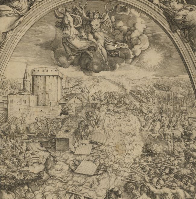
View of the siege of Poitiers, 1569 (Poitiers, Poitou-Charentes, France) 46°35ʹ00ʺN 00°20ʹ00ʺE
1569 or laterEtching with engraving; printed on paper; mounted on paper (Mount Type A); gilt edges top and right | 39.3 x 33.1 cm (image) | RCIN 721050
A high oblique view of Poitiers, commanded by Henry I, Duke of Guise (31 December 1550-23 December 1588), besieged from 24 July to 7 September 1569 by the Huguenot army, commanded by Admiral Gaspard II de Coligny (16 February 1519-24 August 1572), resulting in the abandonment of the siege by the Huguenots. France,Third War of Religion (1568-1570). Oriented with north-north-west to top.
An example of this map, from a Lafreri atlas, with accompanying engraved text, printed from a separate copperplate on the same sheet of paper as the map, is in the BnF GEDD-1140(78RES). The title is given under 'Transcriptions' below and the key from the text is transcribed here:
A. Porta san Lazaro
B. Porta e’ ponte del borgo Rocierolo
C. Porta del ponte Aiubert
D. Porta e’ ponte san Cipriano
E. Porta e’ ponte del Tison
F. Porta la Trincea
G. Porta pont’ asart
H. Chiusa e’ riparo del stagno
I. Molino di dentro
L. Castello
M. Prato della bessa che fu allagato da nostri
O. Reuellino che seruiua sortita de nostri
P. Prima batteria di nimici fatta a porta Jubert con xi cannoni e 1000 tiri.
Q. 2a e 3 a batteria del di di san Lorenzo di passa 30. di muraglia dove da Juluio Quistello et Biasio Capisucco fu tolto il pont a nimici et portato alli nostri.
R. 4. a batteria del di di san Bartholomeo di passa 36.
S. 5. a batteria di passa 50.
T. 6. a et ultima batteria dove al 3 di di Setembro dettero L’assalto
V. Allogg.to del Amiraglio
X. Nostra dama delle pais
Y. S. Benedetto allogg.a del s.r di Ma’stelt
Z. Allogg.to delli Principi di Navarra et Conde.
1. S Pietro
2. S Ilario
3. La Madonna
4. Sta Radiconda
5. Sto Agostino
6. S Germano
7. Monasterio nouo
8. S. Cibardo
9. La Cella
10. S. Gregorio
11. Piazza dell’ Orlogio
12. Mercato Vecchio
13. Il Pilori
14. Vigne del Vescouo
15. Amphiteatro antico ruuinato
16. Il Palazzo
17. Lo studio
18. Il Vescouado
19. Il Prato.
20. Il prato del Vescouo
21. Stagno di S.to Ilario
22. Villaggio, detto Prart
23. Passo Lordino
24. Pietra Leuata
25. Braccio del Clano attorno all muraglia
26. Abbadia di san Cipriano
27. Aquedotti Antiqui.
A redrawn lithographed reproduction of this map/view, taken from an example in the library of Poitiers, was published sometime in the nineteenth century with the title: ‘VUE DE POITIERS / á l’époque du siége de 1569, d’après une gravure Italienne déposée á la Bibliotheque de cette ville.’ (BnF GED-489). The imprint is ‘Lith. Gauvin à Poitiers’ and ‘Létang, Libraire-Editeur, rue de la Mairie, à Poitiers’. At bottom left is written ‘Petri de Nobilibus Formis’. No inscription relating to Nobilibus appears on the original map in the Royal Collection or the BnF. The Italian text has been translated into French.
Pietro de' Nobili (active 1584–85) (publisher)
Subject(s)
Army-Duke of GuiseComte de Coligny Gaspard de Chatillon, Admiral of France (1519-72)Watermark: The letter 'F' over triple mount in a shield [see Heawood no. 2615]
Condition: one fold line to view and mount, not quite coincident; water stained; remnant of an ink framing line for a smaller item on the mount, bottom; impressions from the mounts of items which were kept abelow this map/print in a former sequence are present on the verso and more faintly on the recto
39.3 x 33.1 cm (image)
cropped (platemark)
52.3 x 40.3 cm (mount)
Printed title:
POITIERS [no formal title, top centre]
Printed title:
[Vero disegno della nobilissima Citta di Poitiers, nella Gallia Celtica, Soggi Aquita= / nia detta, e, da Cesare PICTONES populi. Con il tremendo assedio di essa, postol’ alli / xxvii di Luglio questo anno M.D.LXIX [space] da Gasparo / Coligni S.r di Ciatiglion già Amiraglio di Francia. dal Prencipe di Navarra / et di Conde [followed by a short account of the event.]] [engraved title and engraved text are missing from this print]
Annotations:
George III heading: Poitiers 1568.
Other annotations: (Recto) [top, on mount, red pencil:] 1569; [top right, black pencil: 1569]. (Verso) [bottom left, red pencil, on mount:] 1/45; [bottom left, on mount, black pencil, erased:] I/46; [top left, on mount, black pencil, erased:] Poitiers.
George III catalogue entry:
Poitiers A Plan of Poitiers besieged by Admiral Coligni and defended by Henry Duke of Guise, 1568.
Subject(s)
Poitiers, Poitou-Charentes, France (46°35ʹ00ʺN 00°20ʹ00ʺE)
Bibliographic reference(s)
M. McDonald, The Print Collection of Cassiano dal Pozzo. Part II, Architecture, Topography and Military Maps, 3 vols, London 2019, cat. no. 2698
Page revisions
25 May 2024
Current version


