Contemporary maps of 10 sixteenth-century wars
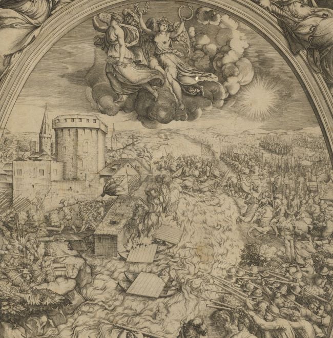
View of the siege of Thionville, 1558 (Thionville, Lorraine, France) 49°22ʹ00ʺN 06°10ʹ00ʺE
1558 or laterEtching with engraving; printed on paper; laid down on paper then mounted on paper (Mount Type A); gilt edges left, bottom and right | 27.8 x 34.4 cm (image and sheet) | RCIN 721028
A medium oblique view of the siege by the French, commanded by Francis, Duke of Guise (17 February 1519-24 February 1563) of the Spanish army at Thionville in May and June resulting in the fall of the town on 22 June 1558. The last Valois-Habsburg War (1547-1559). Oriented with north-west to top (but north is indicated: SEPTENTRIO).
This view appears to show an earlier phase in the attack on Thionville than RCIN 721027; there are no breaches in the walls. The positions of the towers in the walls are reversed in this print. For a description of the action, see RCIN 721027.
Sebastiano di Re (active c. 1557-1563) (engraver) [bottom, right of centre:] Sebastianus faciebat [top left corner, in reversed letters:] BB
Subject(s)
Army-FranceArmy-SpainArmy-Duke of GuiseWatermark: Indistinct: three-runged ladder in double circle (not in Woodward); [on backing paper:] cross in tear drop shape
Condition: no fold lines; old crease marks; cropped to edge of image
27.8 x 34.4 cm (image and sheet)
cropped (platemark)
41.3 x 54.5 cm (mount)
Printed title:
Il uero disegno di Thionuille: il qual hora si batte dall'esercito del Re / Christianissimo, con la giunta delle batterie et de tutti luoghi circouicini. [top centre, in a panel]
Annotations:
George III heading: Thionville 1558.
Other annotations: (Recto) [top left of mount, red pencil:] Thionville 1558; [top centre on mount, very faint black pencil, partly erased:] taken by the Duke of Guise; [bottom right of mount:, black pencil:] 1558. (Verso) [top left, on mount, red pencil:] 1/25 [top left, on mount, indistinct, black pencil:] II/28.
George III catalogue entry:
Thionville Disegno di Thionville il qual hora si batte dall’ Essercito del Re Christianissimo, con la giunta delle Batterie et de tutti luoghi circonvicini. Sebastianus faciebat.
Subject(s)
Thionville, Lorraine, France (49°22ʹ00ʺN 06°10ʹ00ʺE)
Bibliographic reference(s)
M. McDonald, The Print Collection of Cassiano dal Pozzo. Part II, Architecture, Topography and Military Maps, 3 vols, London 2019, cat. no. 2661
R.V. Tooley, ‘Maps in Italian atlases of the sixteenth century, being a comparative list of the Italian maps issued by Lafreri, Forlani, Duchetti, Bertelli and others, found in atlases’, Imago Mundi III, 1939, pp. 12-47,no. 549
Page revisions
25 May 2024
Current version


