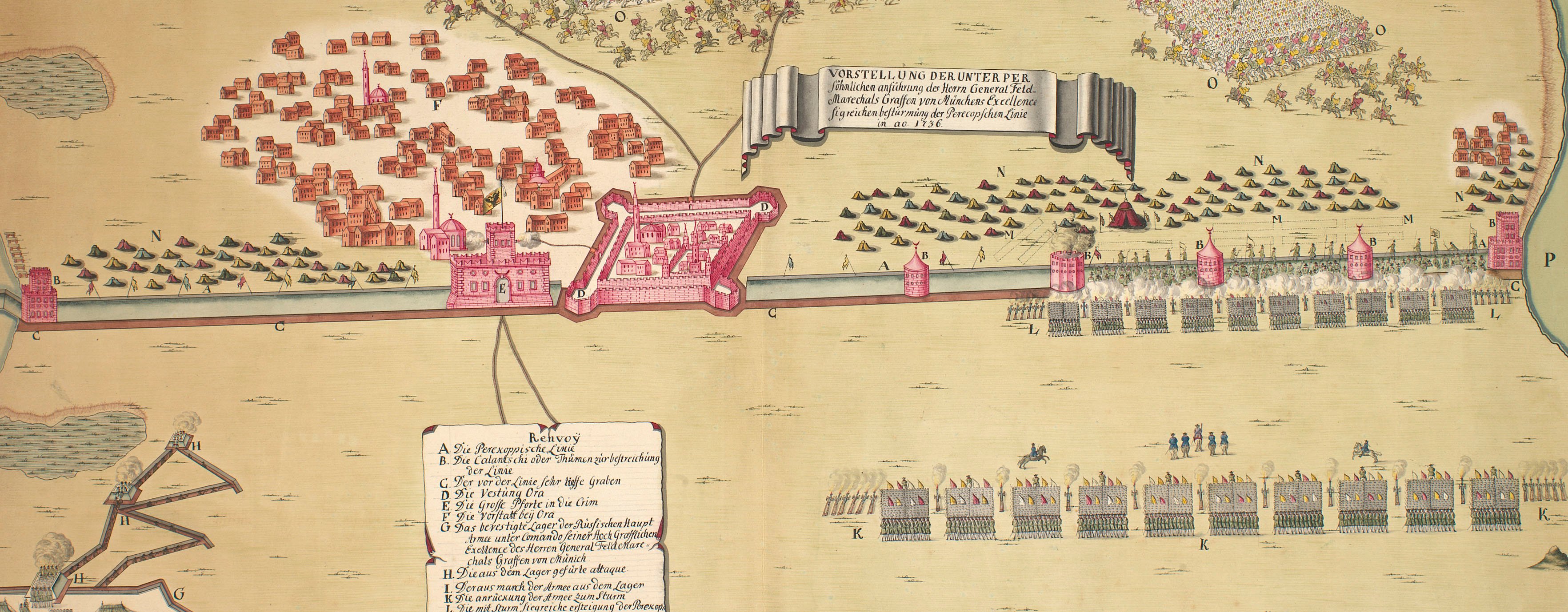
The wars of 1735–9, 1768–74 and 1787–92
Map of Little Tartary and Crimea, 1736-7
1739Woodcut map with letterpress text, printed on one sheet of paper | Scale: 1:2,000,000 approx. | RCIN 728004
? Edward Cave (1691-1754) (printer and publisher)
Subject(s)
Army-RussiaArmy-TurkeyWatermarks: Coat of arms
Condition: four fold lines; trimmed; one crease mark. Verso: water-stained patch from the removal of Cumberland's cipher label
Scale: 1:2,000,000 approx. Scale bars: Russian Wersts [55 mm =] 104½ in a Degree; English Miles [55 mm =] 69½ in a Degree.
29.4 x 35.5 cm (image)
20.6 x 30.3 cm (neatline)
30.3 x 37.4 cm (sheet)
Printed title:
AN / Exact MAP of the CRIM, / (Formerly TAURICA CHERSONESUS) / Part of Lesser Tartary, the Sea of ASOPH, and / the adjacent Country of the Kuban Tartars; as / laid down by the Czarina's Geographers; exhibi- / ting the March of the Russian Armies against the / Crim Tartars, in the War begun with the Turks / 1736, and continued the present Year 1739. [bottom right, in rectangular panel with decorative border]
Additional text:
EXPLANATIONS of this MAP, as published by the Academy at Petersburgh from the Charts sent by the Generals Lacy and Munich, in 1736 and 1737. [bottom, below map, a descriptive key, O-W, Y-Z, and a-i, k-t, w, to the abbreviations on the map:]
Annotations:
George III heading: Little Tartary and Crimea 1736-1737.
Other annotations: (Recto) [top left, black pencil:] 7; [top right, black pencil:] 18. (Verso) [bottom left, black pencil:] 26.
George III catalogue entry:
Tartary, Little Map of the Crim, part of Lesser Tartary, the Sea of Asoph and the adjacent Country of the Kuban Tartars: exhibiting the March of the Russian Armies against the Crim Tartars in 1736 and 1737. [engraved on wood.]
Subject(s)
Crimea
Page revisions
3 November 2024
Current version


