The wars of 1735–9, 1768–74 and 1787–92
Map of Little Tartary and Crimea, 1736
1736 or laterEngraving and some etching; printed on paper | Scale: 1:1,700,000 approx. | RCIN 728007
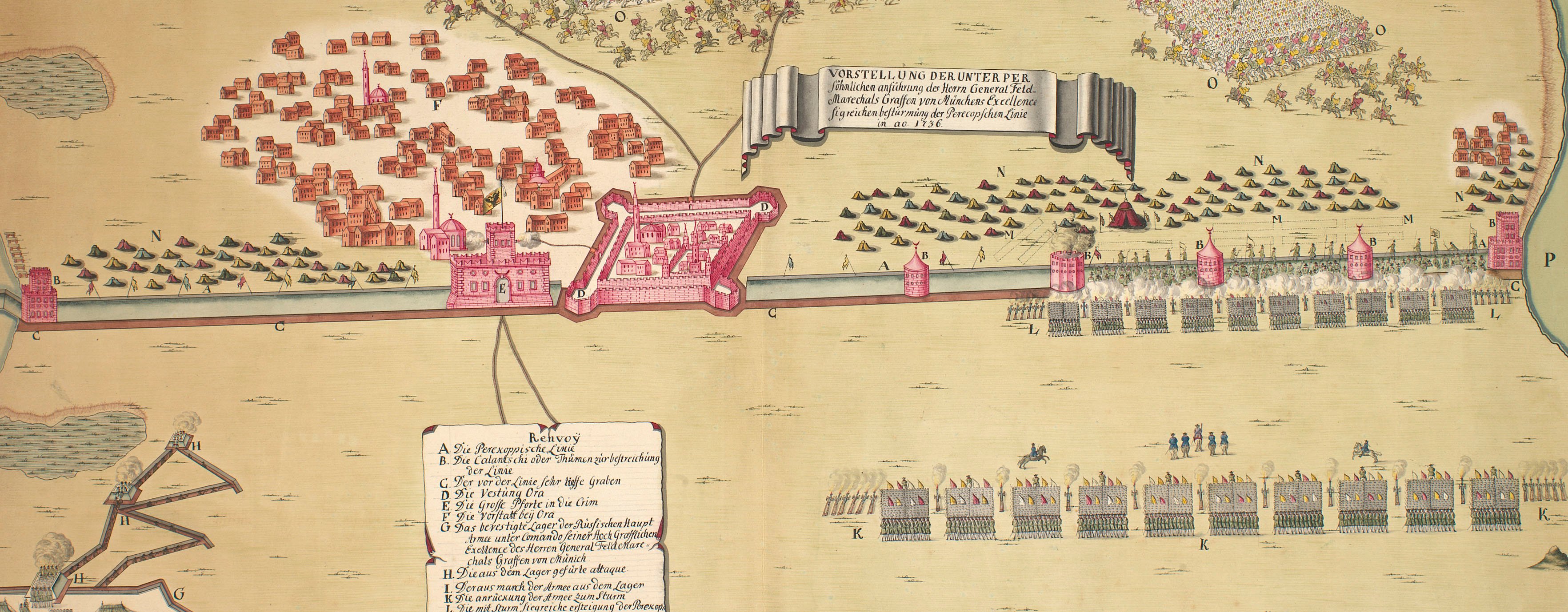
This map shows the marches and operations of the Russian army in 1736 and the extensive fortified line ‘Die Ukrainische Linie’, running from the Dnieper River to the Donets River. The date of publication of 1736 is inferred from the annotation on the verso, which indicates that the map was sent with a dispatch from Rondeau in July 1736. If this were so, it might explain why the rendering of the geographical outlines of the Crimea and elsewhere is primitive compared with that of RCINs 728001.a, b.
The two maps at RCINs 728001.a, b were compiled after 1737 from the operational mapping made under the command of the Generals Munich and Lacy. This map (RCIN 728007) was probably made before these materials became available. The Rondeau referred to in the annotation was probably Claudius Rondeau (1695-1739), who was British Consul, or His Majesty's Resident at the Court of Russia 1730-39, at St Petersburg, and corresponded with Walpole. Rondeau is buried in St Dunstan's Churchyard, Canterbury, Kent.
Additional text: [bottom right, in rectangular panel surmounted by the imperial eagle with standards and armour, a descriptive key, A-I, K-N, to the abbreviations on the map.]
A photograph of Rondeau's memorial plaque is at http://www.findagrave.com/cgi-bin/fg.cgi?page=gr&GRid=27570459 (last accessed 30 June 2016).
Condition: eight fold lines; formerly folded to 10.0 x 7.1 cm; surface dirt on verso of outward folds; torn in half and repaired with a paper strip; another tear, top left, also repaired with a small paper strip; dirty; some foxing.
Russian Academy of Sciences, St. Petersburg (engraver) [top right, below title, in title cartouche:] gestochen bey der / keyserl: Acad: / der Wissensch: / in S=t Petersb:
Subject(s)
Army-RussiaWatermark: Indecipherable
Condition: eight fold lines; formerly folded to 10.0 x 7.1 cm; surface dirt on verso of outward folds; torn in half and repaired with a paper strip; another tear, top left, also repaired with a small paper strip; dirty; some foxing
Scale: 1:1,700,000 approx. Scale bars: Werst [45 mm =] 70. Maastab von 10 Teütschē Meilen [45 mm =].
38.7 x 45.4 cm (neatline)
39.4 x 46.1 cm (image)
39.8 x 46.7 cm (sheet)
Printed title:
CHARTE / der Kriegs Operationen / am Donn und Dnieper / IHRO RUSSISCH / KEYSERL: MAIEST / glorieusen / Armeen / A=o 1736. [top right, in ornate cartouche representing a shield flanked by the artefacts of war and surmounted by the Russian Imperial crown]
Additional text:
[bottom right, in rectangular panel surmounted by the imperial eagle with standards and armour, a descriptive key, A-I, K-N, to the abbreviations on the map.]
Annotations:
George III heading: Little Tartary 1736.
Other annotations: (Recto) none. (Verso) [left centre, red pencil:] 6/79a; [centre, right, obscured by white paper strip, ink:] [?] Rondeau's of 10h July / 1736.
George III catalogue entry:
Tartary, Little Charte der Kriegs Operationen am Donn und Dnieper Ihro Russisch Keyserl. Majest. glorieusen Armeen 1736, gestochen bey der Keyserl. Acad. der Wissenschafften in S.t Petersburg.
Subject(s)
Crimea
Bibliographic reference(s)
A photograph of Rondeau's memorial plaque (accessed 11/04/2019)
W. Coxe, Memoirs of the Life and Administration of Sir Robert Walpole, 3 vols, London 1798, vol.3 ‘containing the correspondence from 1730 to 1745’
L. Loewenson, ‘Lady Rondeau’s letters from Russia (1728-1739)’, The Slavonic and East European Review 35, no. 85, 1957, pp. 399-408
A.W. Ward (ed), The Cambridge Modern History VI, Cambridge 1934, p.308: 'Horace Walpole, in acknowledging the receipt of Münnich's map of the Crimea from Rondeau in 1736, remarked that the eyes of all the world were fixed upon the lines of Perekop'.
Page revisions
3 November 2024
Current version


