War of the Polish Succession (1733-8)
The Rhine and Moselle rivers and parts of Italy
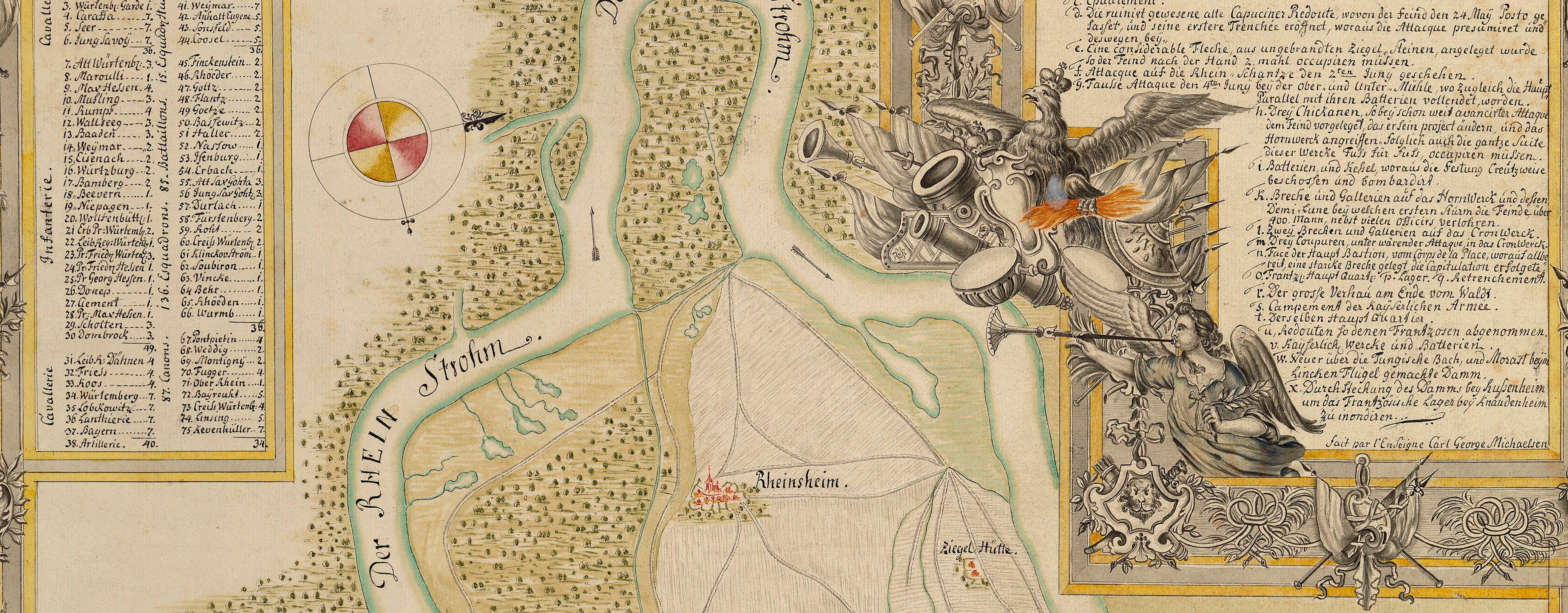
Map of the Rhine, Mainz and Speyer, 1735 (Mainz, Rhineland-Palatinate, Germany) 49°59'03"N 08°16'44"E; (Speyer, Rhineland-Palatinate, Germany) 49°19'47"N 08°25'40"E
1735 or laterEtching and engraving; printed from two copperplates on two sheets of paper, joined; hand-coloured | Scale: 1:95,000 approx. | RCIN 727071
The map extends from Mainz in the north to Speyer in the south, and from Worms (49°38'08"N 08°21'35"E) in the west to Darmstadt (49°52'14"N 08°38'58"E) in the east.
Additional text: [bottom left, in rectangular panel, a list of the regiments of the Auxilliary Corps stationed along the Rhine:] Postirung von denen Auxiliar= Corps, welche længst dem Rhein die Posten gehalten, / und nach und nach erforderlich verændert worden.
Condition: each sheet appears to have been folded separately before being joined together, and subsequently folded again; whole: at least twelve fold lines. Verso: induced discolouration; surface dirt along fold lines and on what would have been the outer panel of the folded item; top, right of centre: water-stained patch and shadow from the removal of Cumberland's cipher label.
Homann's Heirs (1724-1848) (cartographer and publisher) [following on from German title:] Imverlag / Der Homænnischen Erben /Mit Kaÿs. allergn. Privil.
[following on from French title:] Par & chez les Heritiers de Homan[n] à Norimberg.Watermark: Coat of arms, crown above; countermark: large W
Condition: each sheet appears to have been folded separately before being joined together, and subsequently folded again; whole: at least twelve fold lines. Verso: induced discolouration; surface dirt along fold lines and on what would have been the outer panel of the folded item; top, right of centre: water-stained patch and shadow from the removal of Cumberland's cipher label.
Scale: 1:95,000 approx. Scale bar: Scale 2 Horarum Itineris [93 mm =].
32.6 x 92.7 cm (image)
mainly cropped (platemark)
34.3 x 95.2 cm (sheet)
Printed title:
Die Gegenden des Rheins / von SPEYER biss MAYNTZ / nebst der Situation længst / der Bergstrasse / zwischen dem Rhein und dem Odewaldt, / dem Mayn und Necker. 1735. [top, right of centre, in cartouche designed as a swagged, fringed drape]
Printed title:
Les Environs du Rhin, depuis Spire iusqu à Mayence, avec les pais adjacents de la Rue des Montagnes appellée BERGSTRASSE / entre les Rivieres du Rhin, de Main, & de Neckar. [top left, outside map border]
Additional text:
Postirung von denen Auxiliar= Corps, welche længst dem Rhein die Posten gehalten, / und nach und nach erforderlich verændert worden. [bottom left, in rectangular panel, a list of the regiments of the Auxilliary Corps stationed along the Rhine]
Annotations:
George III heading: Cantonments on the Rhine in 1735.
Other annotations: (Recto) [bottom right, ink, cropped and partly erased; illegible.] (Verso) [top, left of centre, black pencil, in Mason's hand?:] 11 [and] 4. [bottom right, black pencil, in Schultz's or Mason's hand, crossed out in black pencil:] B. b 7. [Top right, black pencil, erased:] Rhine; [bottom right, black pencil:] XXVII 1735; [bottom, right of centre, black pencil:] 4 [and] Rhine 1735; [bottom, left of centre, black pencil:] Rhine Speyer & Mentz 1735; [right centre, red pencil:] 11.
George III catalogue entry:
Rhine Les Environs du Rhin depuis Spire jusqu’a Mayence avec les Pais adjacentes de la Rue de Montagnes appellée Bergstrasse entre les Rivieres du Rhin, de Main et de Neckar; avec les Cantonemens de l’Armée Imperiale en 1735; par les Heretiers d’Homann, 1735. 2 feuilles. [The same entry appears under the heading Cantonment.]
Subject(s)
Mainz, Rhineland-Palatinate, Germany (49°59'03"N 08°16'44"E)
Speyer, Rhineland-Palatinate, Germany (49°19'47"N 08°25'40"E)


