War of the Polish Succession (1733-8)
The Rhine and Moselle rivers and parts of Italy
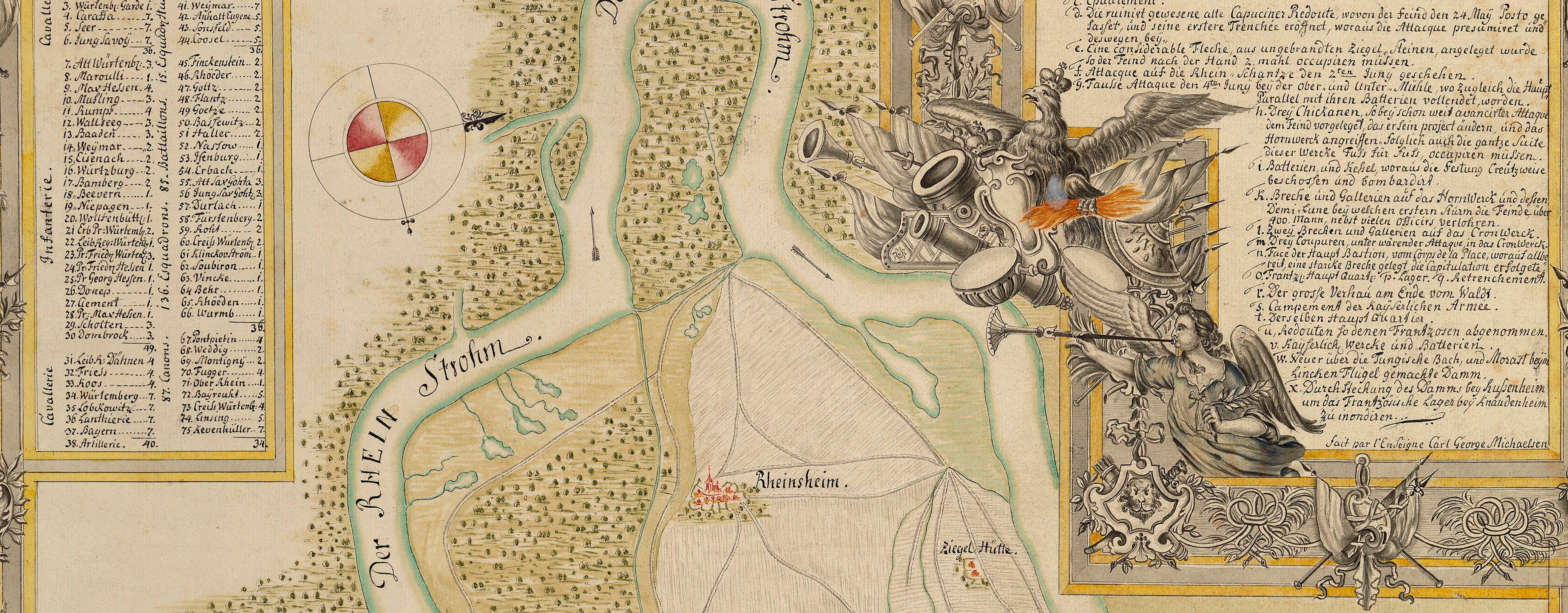
Map of the siege of Philippsburg, 1734 (Philippsburg, Baden-Württemberg, Germany) 49°13ʹ54ʺN 08°27ʹ39ʺE
1734 or laterEtching and engraving; printed on paper | Scale: 1:23,500 approx. | RCIN 727050
Additional text: [top left, in a trompe l'oeil scroll, a key, a-i, k-u, w, x, z, to the attacks, batteries, and fortifications:] Erklærung der Buchstaben. [Bottom left, above a view of Philippsburg, in draped cartouche, a key, a-i:] Das durch die Bomben / ruinirte / PHILIPSBURG.
Condition: six fold lines; a tear to the horizontal fold has been repaired by a paper strip pasted to the verso. Verso: bottom centre, water-stained patch and shadow from the removal of Cumberland's cipher label; bottom left, some offsetting from letterpress text; worn and surface dirt along folds.
Adam Jonathan Felseckers : Nuremberg (publisher) [top right, following on from title, in title cartouche:] auf das accurateste vorgestellet / von / Einem berühmten Ingenieur L.S.C. / Nürnberg / Verlegt con Adam Ionathan / Felseckers, S. Erben.
LSC (active 1734) (surveyor and draughtsman)
Subject(s)
Army-FranceArmy-AustriaWatermark: Coat of arms: a shield divided into three, with half an eagle in the left part, a fleur-de-lys in the right part, blank in the top, crown above, the letters AV below
Condition: six fold lines; a tear to the horizontal fold has been repaired by a paper strip pasted to the verso. Verso: bottom centre, water-stained patch and shadow from the removal of Cumberland's cipher label; bottom left, some offsetting from letterpress text; worn and surface dirt along folds
Scale: 1:23,500 approx. Scale bar: Maaßstab Fr. Pied [123 mm = 8000].
47.7 x 58.2 cm (image and neatline)
48.6 x 59.1 cm (platemark)
52.3 x 64.2 cm (sheet)
Printed title:
Grundris / der Vestung / PHILIPPSBVRG / nebst / Denen Feindlichen Attaquen, Cirumvalations – Linien u: Batterien / aus welchen die Französische Armee den 23. May. 1734. die Vestung / zu belagern, und den 7. Iuny, selbige zu beschiessen angefangen, und / nach tapferer Defension des Com[m]endanten, Herrn General-Feld- / Marschall-Leutenanten, Baron v: Wuttgenau, erst den 18. Iuly, / per Accord erobert / wie auch / die Situation / der Kayserlichen u: Reichs-armee, so bey Wiesenthal campirt, und gegen die / Feidliche zu approchiren angefangen, … [top right, in cartouche decorated with leaves]
Additional text:
Erklærung der Buchstaben. [top left, in a trompe l'oeil scroll, a key, a-i, k-u, w, x, z, to the attacks, batteries, and fortifications:]; Das durch die Bomben / ruinirte / PHILIPSBURG. [Bottom left, above a view of Philippsburg, in draped cartouche, a key, a-i:]
Annotations:
George III heading: Siege of Philipsbourg 23 May - 18 July 1734 and Encampment near D.o 1- 22 July 1734.
Other annotations: (Recto) [top right, ink, in Schultz's hand?:] Germany [an erased name below, both bracketed] 4. (Verso) [top right, black pencil:] B: b. 2; [top right, black pencil:] 4; [top right, black pencil:] 1734; [bottom right, black pencil, cropped: numbers?]; [bottom centre, black pencil:] Philipsburg 1734; [bottom centre, black pencil:] 8.
George III catalogue entry:
Philipsbourg A Plan of Philipsbourg with the Attacks, Lines of Circumvallation and Batteries, besieged by the French the 23.d May and taken the 18.th July 1734, likewise the Encampment of the Imperialists at Wiesenthal: published by A.I. Felseckers. [The same entry appears under the heading Encampment.]
Subject(s)
Philippsburg, Baden-Württemberg, Germany (49°13ʹ54ʺN 08°27ʹ39ʺE)


